SFIN Lafayette, IN, USA - Earthquake Result Viewer
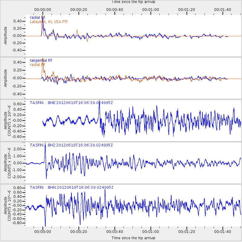
Earthquake location: Near Islands, Aleutian Islands
Earthquake latitude/longitude: 53.4/171.6
Earthquake time(UTC): 2012/06/19 (171) 15:56:32 GMT
Earthquake Depth: 14 km
Earthquake Magnitude: 6.2 MB, 5.7 MS, 6.0 MW, 6.1 MW
Earthquake Catalog/Contributor: WHDF/NEIC
Network: TA USArray Transportable Network (new EarthScope stations)
Station: SFIN Lafayette, IN, USA
Lat/Lon: 40.38 N/87.10 W
Elevation: 165 m
Distance: 64.7 deg
Az: 55.937 deg
Baz: 319.45 deg
Ray Param: 0.058726635
Estimated Moho Depth: 16.0 km
Estimated Crust Vp/Vs: 1.60
Assumed Crust Vp: 6.498 km/s
Estimated Crust Vs: 4.061 km/s
Estimated Crust Poisson's Ratio: 0.18
Radial Match: 84.22397 %
Radial Bump: 400
Transverse Match: 73.63981 %
Transverse Bump: 400
SOD ConfigId: 460165
Insert Time: 2013-02-11 22:01:18.372 +0000
GWidth: 2.5
Max Bumps: 400
Tol: 0.001

Signal To Noise

ChannelStoNSTALTA
TA:SFIN: :BHZ:20120619T16:06:39.024995Z9.1891819.4859337E-71.0322937E-7
TA:SFIN: :BHN:20120619T16:06:39.024995Z3.85861972.916409E-77.558167E-8
TA:SFIN: :BHE:20120619T16:06:39.024995Z2.88976142.8015592E-79.694777E-8
Arrivals
Ps1.6 SECOND
PpPs6.1 SECOND
PsPs/PpSs7.7 SECOND