
N02D Trinity Center, CA, USA - Earthquake Result Viewer
| ||||||||||||||||||
| ||||||||||||||||||
| ||||||||||||||||||
|
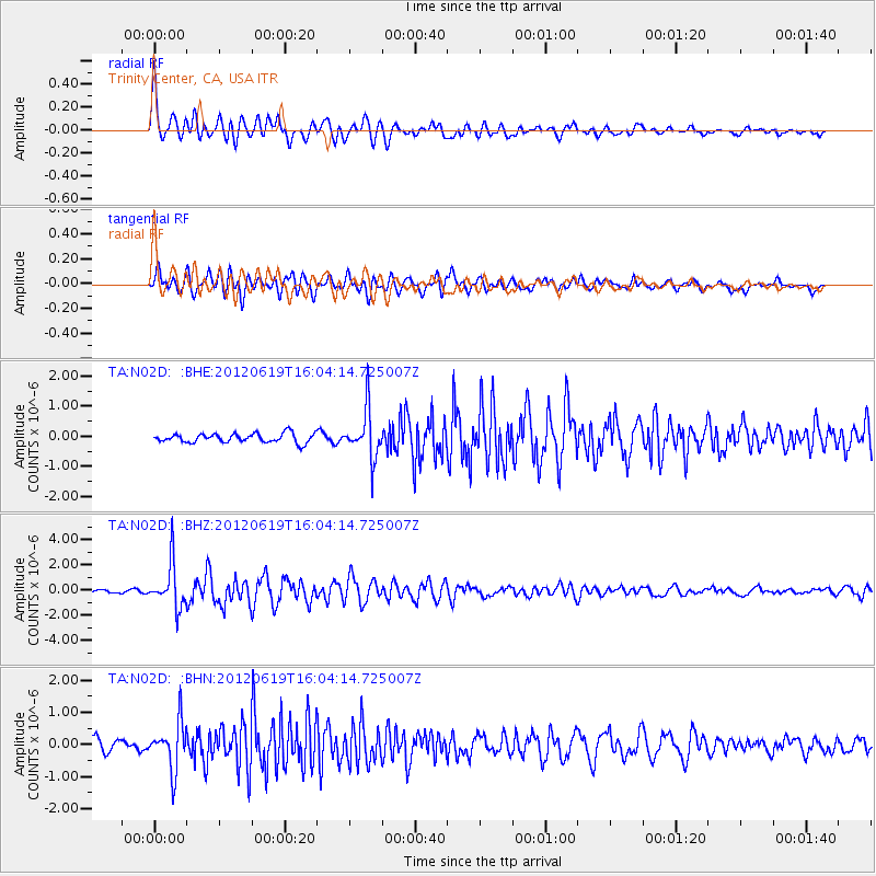
Signal To Noise
| Channel | StoN | STA | LTA |
| TA:N02D: :BHZ:20120619T16:04:14.725007Z | 11.633352 | 1.7316953E-6 | 1.4885609E-7 |
| TA:N02D: :BHN:20120619T16:04:14.725007Z | 3.132723 | 7.2460017E-7 | 2.3130042E-7 |
| TA:N02D: :BHE:20120619T16:04:14.725007Z | 5.3034153 | 7.8869186E-7 | 1.4871395E-7 |
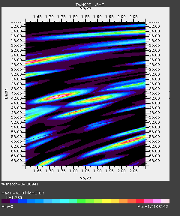
| Arrivals | |
| Ps | 4.9 SECOND |
| PpPs | 16 SECOND |
| PsPs/PpSs | 21 SECOND |

