D34A Park Rapids, MN, USA - Earthquake Result Viewer
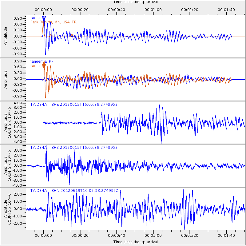
Earthquake location: Near Islands, Aleutian Islands
Earthquake latitude/longitude: 53.4/171.6
Earthquake time(UTC): 2012/06/19 (171) 15:56:32 GMT
Earthquake Depth: 14 km
Earthquake Magnitude: 6.2 MB, 5.7 MS, 6.0 MW, 6.1 MW
Earthquake Catalog/Contributor: WHDF/NEIC
Network: TA USArray Transportable Network (new EarthScope stations)
Station: D34A Park Rapids, MN, USA
Lat/Lon: 47.09 N/95.20 W
Elevation: 476 m
Distance: 55.8 deg
Az: 55.549 deg
Baz: 313.664 deg
Ray Param: 0.064525075
Estimated Moho Depth: 31.5 km
Estimated Crust Vp/Vs: 1.75
Assumed Crust Vp: 6.419 km/s
Estimated Crust Vs: 3.668 km/s
Estimated Crust Poisson's Ratio: 0.26
Radial Match: 93.05755 %
Radial Bump: 400
Transverse Match: 89.26361 %
Transverse Bump: 400
SOD ConfigId: 460165
Insert Time: 2013-02-11 22:05:19.611 +0000
GWidth: 2.5
Max Bumps: 400
Tol: 0.001

Signal To Noise

ChannelStoNSTALTA
TA:D34A: :BHZ:20120619T16:05:38.274995Z22.3739551.3664758E-66.10744E-8
TA:D34A: :BHN:20120619T16:05:38.274995Z12.30977251.0188905E-68.277087E-8
TA:D34A: :BHE:20120619T16:05:38.274995Z14.3984291.0332722E-67.176284E-8
Arrivals
Ps3.9 SECOND
PpPs13 SECOND
PsPs/PpSs17 SECOND