G32A Webster, SD, USA - Earthquake Result Viewer
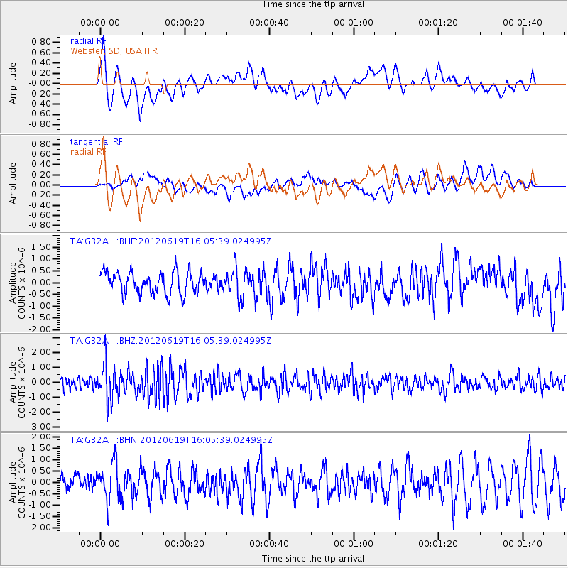
Earthquake location: Near Islands, Aleutian Islands
Earthquake latitude/longitude: 53.4/171.6
Earthquake time(UTC): 2012/06/19 (171) 15:56:32 GMT
Earthquake Depth: 14 km
Earthquake Magnitude: 6.2 MB, 5.7 MS, 6.0 MW, 6.1 MW
Earthquake Catalog/Contributor: WHDF/NEIC
Network: TA USArray Transportable Network (new EarthScope stations)
Station: G32A Webster, SD, USA
Lat/Lon: 45.26 N/97.50 W
Elevation: 566 m
Distance: 55.9 deg
Az: 58.483 deg
Baz: 313.652 deg
Ray Param: 0.064456895
Estimated Moho Depth: 40.75 km
Estimated Crust Vp/Vs: 1.63
Assumed Crust Vp: 6.552 km/s
Estimated Crust Vs: 4.008 km/s
Estimated Crust Poisson's Ratio: 0.20
Radial Match: 83.46898 %
Radial Bump: 400
Transverse Match: 73.85827 %
Transverse Bump: 400
SOD ConfigId: 460165
Insert Time: 2013-02-11 22:06:00.317 +0000
GWidth: 2.5
Max Bumps: 400
Tol: 0.001

Signal To Noise

ChannelStoNSTALTA
TA:G32A: :BHZ:20120619T16:05:39.024995Z3.87286851.2209244E-63.1525067E-7
TA:G32A: :BHN:20120619T16:05:39.024995Z2.714638.2079436E-73.0235958E-7
TA:G32A: :BHE:20120619T16:05:39.024995Z1.32670146.055458E-74.5642958E-7
Arrivals
Ps4.2 SECOND
PpPs15 SECOND
PsPs/PpSs20 SECOND