You are here: Home > Network List > TA - USArray Transportable Network (new EarthScope stations) Stations List
> Station Q53A Leroy, WV, USA > Earthquake Result Viewer
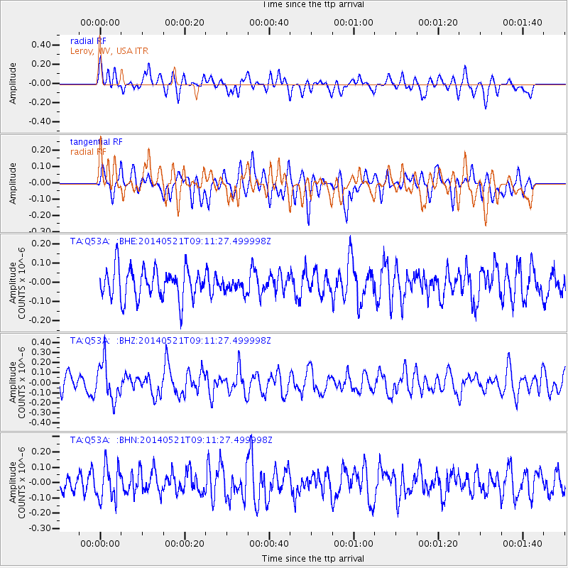
Q53A Leroy, WV, USA - Earthquake Result Viewer
*The percent match for this event was below the threshold and hence no stack was calculated.
| Earthquake location: |
Near Coast Of Central Chile |
| Earthquake latitude/longitude: |
-30.4/-71.4 |
| Earthquake time(UTC): |
2014/05/21 (141) 09:00:53 GMT |
| Earthquake Depth: |
41 km |
| Earthquake Magnitude: |
5.1 MW |
| Earthquake Catalog/Contributor: |
ISC/ISC |
|
| Network: |
TA USArray Transportable Network (new EarthScope stations) |
| Station: |
Q53A Leroy, WV, USA |
| Lat/Lon: |
38.86 N/81.53 W |
| Elevation: |
310 m |
|
| Distance: |
69.6 deg |
| Az: |
351.548 deg |
| Baz: |
170.643 deg |
| Ray Param: |
$rayparam |
*The percent match for this event was below the threshold and hence was not used in the summary stack. |
|
| Radial Match: |
54.771553 % |
| Radial Bump: |
400 |
| Transverse Match: |
58.073082 % |
| Transverse Bump: |
400 |
| SOD ConfigId: |
3390531 |
| Insert Time: |
2019-04-11 23:37:13.444 +0000 |
| GWidth: |
2.5 |
| Max Bumps: |
400 |
| Tol: |
0.001 |
|
Signal To Noise
| Channel | StoN | STA | LTA |
| TA:Q53A: :BHZ:20140521T09:11:27.499998Z | 1.9792551 | 1.8954916E-7 | 9.576792E-8 |
| TA:Q53A: :BHN:20140521T09:11:27.499998Z | 1.9598918 | 1.11741265E-7 | 5.7013995E-8 |
| TA:Q53A: :BHE:20140521T09:11:27.499998Z | 0.43145832 | 3.4202774E-8 | 7.927248E-8 |
| Arrivals |
| Ps | |
| PpPs | |
| PsPs/PpSs | |


