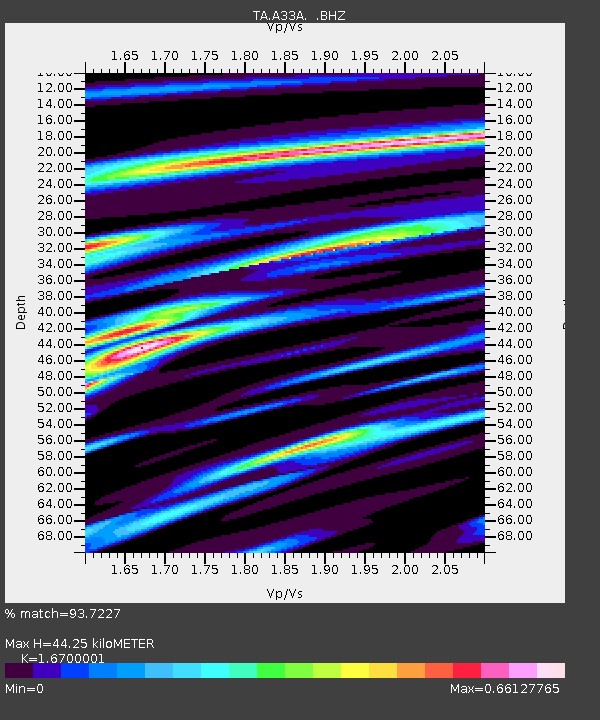
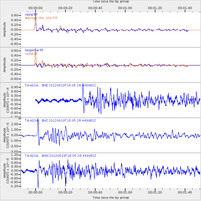
A33A Warroad, MN, USA - Earthquake Result Viewer

Earthquake location: Near Islands, Aleutian Islands
Earthquake latitude/longitude: 53.4/171.6
Earthquake time(UTC): 2012/06/19 (171) 15:56:32 GMT
Earthquake Depth: 14 km
Earthquake Magnitude: 6.2 MB, 5.7 MS, 6.0 MW, 6.1 MW
Earthquake Catalog/Contributor: WHDF/NEIC
Network: TA USArray Transportable Network (new EarthScope stations)
Station: A33A Warroad, MN, USA
Lat/Lon: 48.94 N/95.39 W
Elevation: 329 m
Distance: 54.5 deg
Az: 54.011 deg
Baz: 312.64 deg
Ray Param: 0.06541753
Estimated Moho Depth: 44.25 km
Estimated Crust Vp/Vs: 1.67
Assumed Crust Vp: 6.419 km/s
Estimated Crust Vs: 3.844 km/s
Estimated Crust Poisson's Ratio: 0.22
Radial Match: 93.7227 %
Radial Bump: 369
Transverse Match: 80.31235 %
Transverse Bump: 400
SOD ConfigId: 460165
Insert Time: 2013-02-11 22:07:20.972 +0000
GWidth: 2.5
Max Bumps: 400
Tol: 0.001

Signal To Noise

ChannelStoNSTALTA
TA:A33A: :BHZ:20120619T16:05:28.449983Z13.2595749.859904E-77.4360635E-8
TA:A33A: :BHN:20120619T16:05:28.449983Z6.4508164.1911997E-76.4971616E-8
TA:A33A: :BHE:20120619T16:05:28.449983Z5.6461753.9220436E-76.946373E-8
Arrivals
Ps4.9 SECOND
PpPs17 SECOND
PsPs/PpSs22 SECOND