You are here: Home > Network List > TA - USArray Transportable Network (new EarthScope stations) Stations List
> Station J36A Seneca 1, Swea City, IA, USA > Earthquake Result Viewer
J36A Seneca 1, Swea City, IA, USA - Earthquake Result Viewer

| Earthquake location: |
Near Islands, Aleutian Islands |
| Earthquake latitude/longitude: |
53.4/171.6 |
| Earthquake time(UTC): |
2012/06/19 (171) 15:56:32 GMT |
| Earthquake Depth: |
14 km |
| Earthquake Magnitude: |
6.2 MB, 5.7 MS, 6.0 MW, 6.1 MW |
| Earthquake Catalog/Contributor: |
WHDF/NEIC |
|
| Network: |
TA USArray Transportable Network (new EarthScope stations) |
| Station: |
J36A Seneca 1, Swea City, IA, USA |
| Lat/Lon: |
43.33 N/94.34 W |
| Elevation: |
370 m |
|
| Distance: |
58.9 deg |
| Az: |
58.215 deg |
| Baz: |
315.707 deg |
| Ray Param: |
0.062529445 |
| Estimated Moho Depth: |
49.0 km |
| Estimated Crust Vp/Vs: |
1.65 |
| Assumed Crust Vp: |
6.53 km/s |
| Estimated Crust Vs: |
3.952 km/s |
| Estimated Crust Poisson's Ratio: |
0.21 |
|
| Radial Match: |
86.13504 % |
| Radial Bump: |
400 |
| Transverse Match: |
74.038284 % |
| Transverse Bump: |
400 |
| SOD ConfigId: |
460165 |
| Insert Time: |
2013-02-11 22:07:38.422 +0000 |
| GWidth: |
2.5 |
| Max Bumps: |
400 |
| Tol: |
0.001 |
|
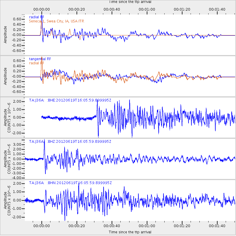
Signal To Noise
| Channel | StoN | STA | LTA |
| TA:J36A: :BHZ:20120619T16:05:59.899995Z | 12.647478 | 1.3511985E-6 | 1.0683541E-7 |
| TA:J36A: :BHN:20120619T16:05:59.899995Z | 4.1509995 | 4.955433E-7 | 1.1937928E-7 |
| TA:J36A: :BHE:20120619T16:05:59.899995Z | 7.619236 | 9.1678726E-7 | 1.2032535E-7 |
| Arrivals |
| Ps | 5.2 SECOND |
| PpPs | 19 SECOND |
| PsPs/PpSs | 24 SECOND |


