P38A Dawn, MO, USA - Earthquake Result Viewer
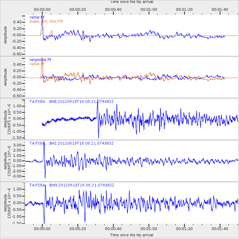
Earthquake location: Near Islands, Aleutian Islands
Earthquake latitude/longitude: 53.4/171.6
Earthquake time(UTC): 2012/06/19 (171) 15:56:32 GMT
Earthquake Depth: 14 km
Earthquake Magnitude: 6.2 MB, 5.7 MS, 6.0 MW, 6.1 MW
Earthquake Catalog/Contributor: WHDF/NEIC
Network: TA USArray Transportable Network (new EarthScope stations)
Station: P38A Dawn, MO, USA
Lat/Lon: 39.62 N/93.53 W
Elevation: 248 m
Distance: 62.0 deg
Az: 60.632 deg
Baz: 317.433 deg
Ray Param: 0.06049892
Estimated Moho Depth: 48.0 km
Estimated Crust Vp/Vs: 1.88
Assumed Crust Vp: 6.498 km/s
Estimated Crust Vs: 3.452 km/s
Estimated Crust Poisson's Ratio: 0.30
Radial Match: 83.787315 %
Radial Bump: 400
Transverse Match: 63.972218 %
Transverse Bump: 400
SOD ConfigId: 460165
Insert Time: 2013-02-11 22:10:24.771 +0000
GWidth: 2.5
Max Bumps: 400
Tol: 0.001

Signal To Noise

ChannelStoNSTALTA
TA:P38A: :BHZ:20120619T16:06:21.074983Z15.4799281.2259347E-67.919512E-8
TA:P38A: :BHN:20120619T16:06:21.074983Z5.76431374.945078E-78.57878E-8
TA:P38A: :BHE:20120619T16:06:21.074983Z3.52518255.510408E-71.5631555E-7
Arrivals
Ps6.8 SECOND
PpPs20 SECOND
PsPs/PpSs27 SECOND