You are here: Home > Network List > TA - USArray Transportable Network (new EarthScope stations) Stations List
> Station O40A La Belle, MO, USA > Earthquake Result Viewer
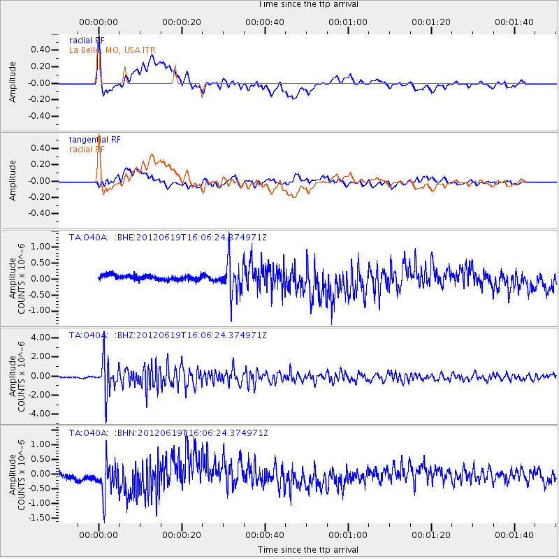
O40A La Belle, MO, USA - Earthquake Result Viewer
*The percent match for this event was below the threshold and hence no stack was calculated.
| Earthquake location: |
Near Islands, Aleutian Islands |
| Earthquake latitude/longitude: |
53.4/171.6 |
| Earthquake time(UTC): |
2012/06/19 (171) 15:56:32 GMT |
| Earthquake Depth: |
14 km |
| Earthquake Magnitude: |
6.2 MB, 5.7 MS, 6.0 MW, 6.1 MW |
| Earthquake Catalog/Contributor: |
WHDF/NEIC |
|
| Network: |
TA USArray Transportable Network (new EarthScope stations) |
| Station: |
O40A La Belle, MO, USA |
| Lat/Lon: |
40.12 N/91.87 W |
| Elevation: |
206 m |
|
| Distance: |
62.5 deg |
| Az: |
59.19 deg |
| Baz: |
317.82 deg |
| Ray Param: |
$rayparam |
*The percent match for this event was below the threshold and hence was not used in the summary stack. |
|
| Radial Match: |
50.555733 % |
| Radial Bump: |
400 |
| Transverse Match: |
62.412178 % |
| Transverse Bump: |
400 |
| SOD ConfigId: |
460165 |
| Insert Time: |
2013-02-11 22:11:22.313 +0000 |
| GWidth: |
2.5 |
| Max Bumps: |
400 |
| Tol: |
0.001 |
|
Signal To Noise
| Channel | StoN | STA | LTA |
| TA:O40A: :BHZ:20120619T16:06:24.374971Z | 31.905214 | 1.7311572E-6 | 5.4259385E-8 |
| TA:O40A: :BHN:20120619T16:06:24.374971Z | 6.176582 | 5.314258E-7 | 8.603883E-8 |
| TA:O40A: :BHE:20120619T16:06:24.374971Z | 6.944411 | 5.155909E-7 | 7.424545E-8 |
| Arrivals |
| Ps | |
| PpPs | |
| PsPs/PpSs | |


