T40A Mansfield, MO, USA - Earthquake Result Viewer
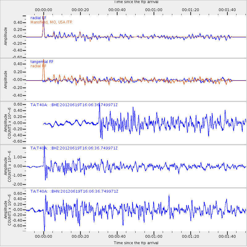
Earthquake location: Near Islands, Aleutian Islands
Earthquake latitude/longitude: 53.4/171.6
Earthquake time(UTC): 2012/06/19 (171) 15:56:32 GMT
Earthquake Depth: 14 km
Earthquake Magnitude: 6.2 MB, 5.7 MS, 6.0 MW, 6.1 MW
Earthquake Catalog/Contributor: WHDF/NEIC
Network: TA USArray Transportable Network (new EarthScope stations)
Station: T40A Mansfield, MO, USA
Lat/Lon: 37.15 N/92.52 W
Elevation: 399 m
Distance: 64.4 deg
Az: 61.821 deg
Baz: 318.595 deg
Ray Param: 0.058949642
Estimated Moho Depth: 64.5 km
Estimated Crust Vp/Vs: 1.85
Assumed Crust Vp: 6.53 km/s
Estimated Crust Vs: 3.53 km/s
Estimated Crust Poisson's Ratio: 0.29
Radial Match: 84.14565 %
Radial Bump: 400
Transverse Match: 74.10457 %
Transverse Bump: 400
SOD ConfigId: 460165
Insert Time: 2013-02-11 22:11:37.331 +0000
GWidth: 2.5
Max Bumps: 400
Tol: 0.001

Signal To Noise

ChannelStoNSTALTA
TA:T40A: :BHZ:20120619T16:06:36.749971Z11.9190437.40712E-76.214526E-8
TA:T40A: :BHN:20120619T16:06:36.749971Z7.1830882.613928E-73.6390034E-8
TA:T40A: :BHE:20120619T16:06:36.749971Z4.79687262.3876825E-74.9775817E-8
Arrivals
Ps8.8 SECOND
PpPs27 SECOND
PsPs/PpSs36 SECOND