
W39A Magazine, AR, USA - Earthquake Result Viewer
| ||||||||||||||||||
| ||||||||||||||||||
| ||||||||||||||||||
|
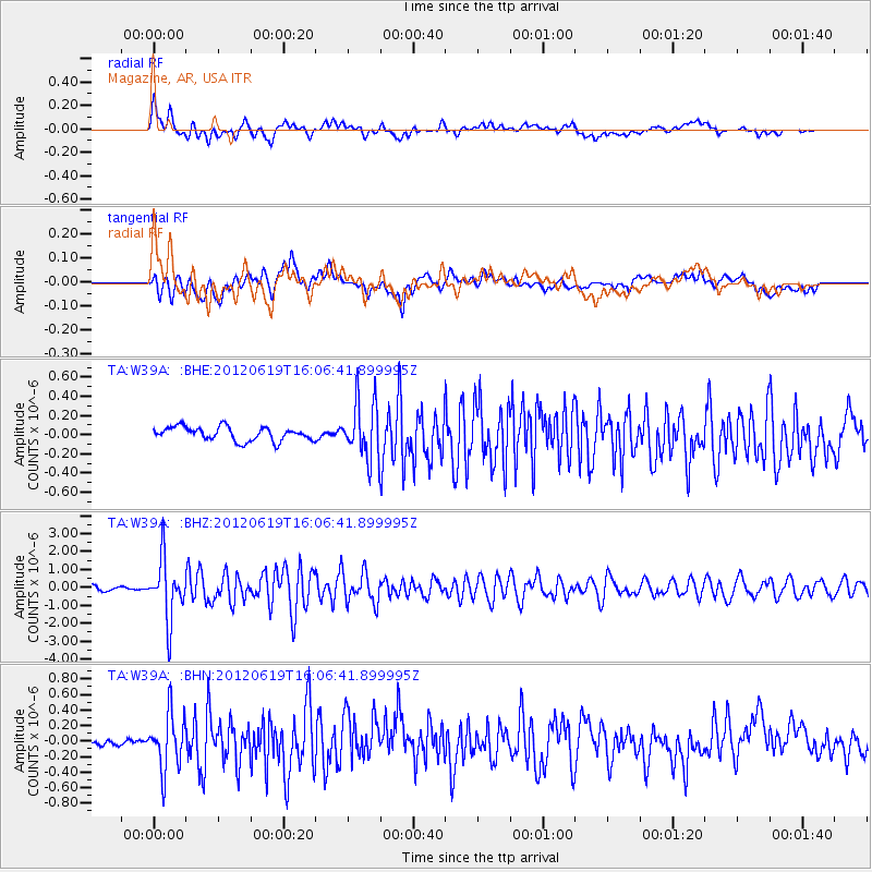
Signal To Noise
| Channel | StoN | STA | LTA |
| TA:W39A: :BHZ:20120619T16:06:41.899995Z | 14.120329 | 1.6656187E-6 | 1.1795891E-7 |
| TA:W39A: :BHN:20120619T16:06:41.899995Z | 4.7451077 | 3.578652E-7 | 7.5417724E-8 |
| TA:W39A: :BHE:20120619T16:06:41.899995Z | 4.1683187 | 2.9933872E-7 | 7.181282E-8 |
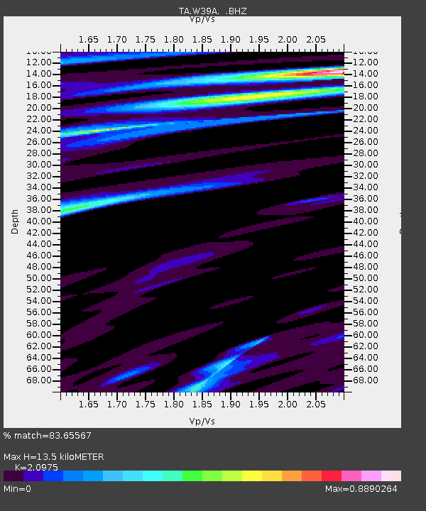
| Arrivals | |
| Ps | 2.4 SECOND |
| PpPs | 6.2 SECOND |
| PsPs/PpSs | 8.6 SECOND |

