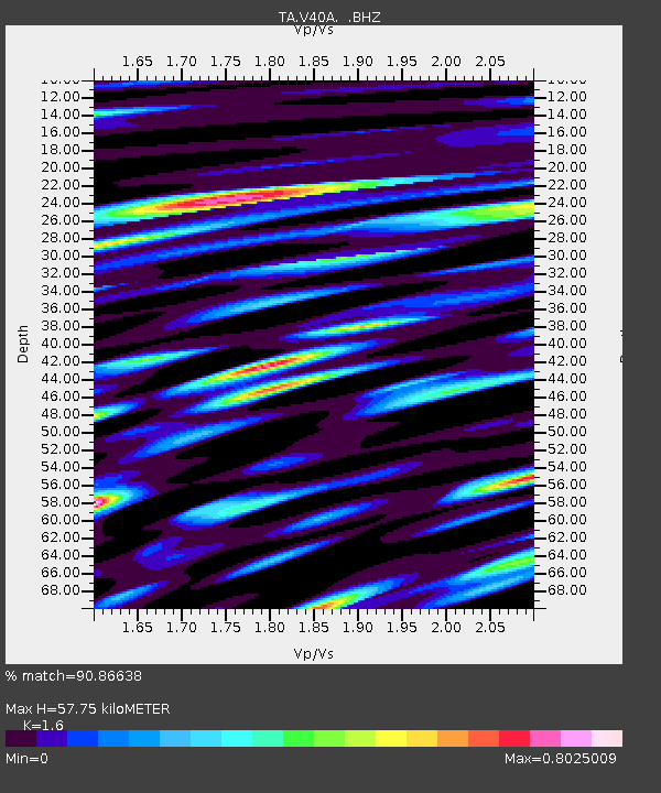
V40A Witts Springs, AR, USA - Earthquake Result Viewer
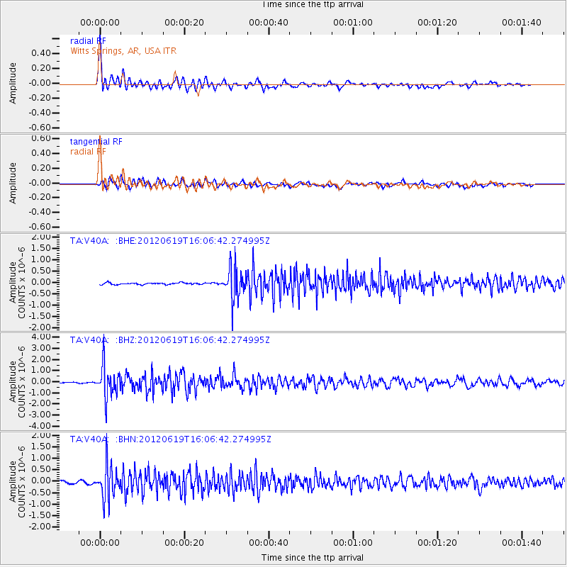
Earthquake location: Near Islands, Aleutian Islands
Earthquake latitude/longitude: 53.4/171.6
Earthquake time(UTC): 2012/06/19 (171) 15:56:32 GMT
Earthquake Depth: 14 km
Earthquake Magnitude: 6.2 MB, 5.7 MS, 6.0 MW, 6.1 MW
Earthquake Catalog/Contributor: WHDF/NEIC
Network: TA USArray Transportable Network (new EarthScope stations)
Station: V40A Witts Springs, AR, USA
Lat/Lon: 35.80 N/92.82 W
Elevation: 570 m
Distance: 65.2 deg
Az: 63.003 deg
Baz: 318.919 deg
Ray Param: 0.058399826
Estimated Moho Depth: 57.75 km
Estimated Crust Vp/Vs: 1.60
Assumed Crust Vp: 6.498 km/s
Estimated Crust Vs: 4.061 km/s
Estimated Crust Poisson's Ratio: 0.18
Radial Match: 90.86638 %
Radial Bump: 400
Transverse Match: 81.021286 %
Transverse Bump: 400
SOD ConfigId: 460165
Insert Time: 2013-02-11 22:13:13.001 +0000
GWidth: 2.5
Max Bumps: 400
Tol: 0.001

Signal To Noise

ChannelStoNSTALTA
TA:V40A: :BHZ:20120619T16:06:42.274995Z27.7993761.4362429E-65.1664575E-8
TA:V40A: :BHN:20120619T16:06:42.274995Z10.0653447.1283694E-77.0820924E-8
TA:V40A: :BHE:20120619T16:06:42.274995Z18.4140976.8800074E-73.7362717E-8
Arrivals
Ps5.6 SECOND
PpPs22 SECOND
PsPs/PpSs28 SECOND