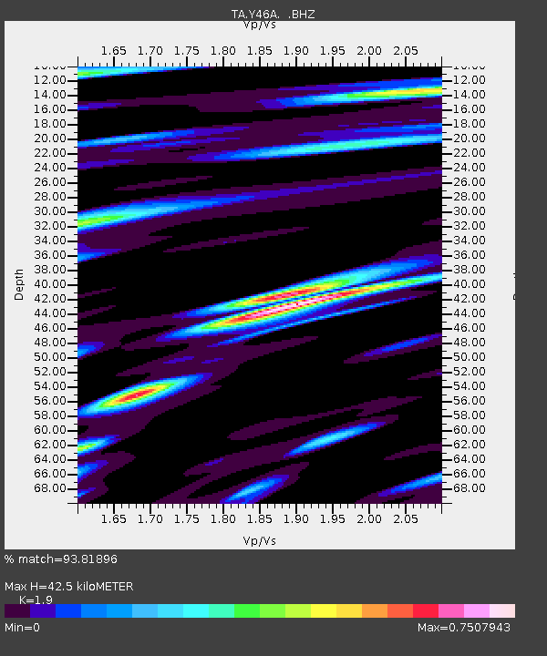
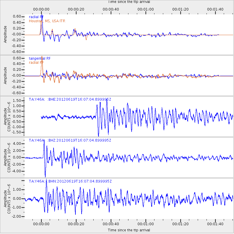
Y46A Houston, MS, USA - Earthquake Result Viewer

Earthquake location: Near Islands, Aleutian Islands
Earthquake latitude/longitude: 53.4/171.6
Earthquake time(UTC): 2012/06/19 (171) 15:56:32 GMT
Earthquake Depth: 14 km
Earthquake Magnitude: 6.2 MB, 5.7 MS, 6.0 MW, 6.1 MW
Earthquake Catalog/Contributor: WHDF/NEIC
Network: TA USArray Transportable Network (new EarthScope stations)
Station: Y46A Houston, MS, USA
Lat/Lon: 33.88 N/88.86 W
Elevation: 109 m
Distance: 68.8 deg
Az: 61.642 deg
Baz: 320.643 deg
Ray Param: 0.05605915
Estimated Moho Depth: 42.5 km
Estimated Crust Vp/Vs: 1.90
Assumed Crust Vp: 6.201 km/s
Estimated Crust Vs: 3.264 km/s
Estimated Crust Poisson's Ratio: 0.31
Radial Match: 93.81896 %
Radial Bump: 391
Transverse Match: 84.959526 %
Transverse Bump: 400
SOD ConfigId: 460165
Insert Time: 2013-02-11 22:16:02.765 +0000
GWidth: 2.5
Max Bumps: 400
Tol: 0.001

Signal To Noise

ChannelStoNSTALTA
TA:Y46A: :BHZ:20120619T16:07:04.899995Z32.169052.1777412E-66.769679E-8
TA:Y46A: :BHN:20120619T16:07:04.899995Z8.7343278.4183597E-79.6382465E-8
TA:Y46A: :BHE:20120619T16:07:04.899995Z9.2493368.050805E-78.7041975E-8
Arrivals
Ps6.4 SECOND
PpPs19 SECOND
PsPs/PpSs26 SECOND