X44A Crenshaw, MS, USA - Earthquake Result Viewer
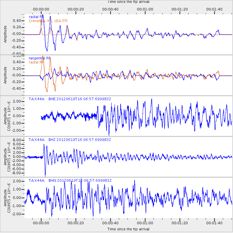
Earthquake location: Near Islands, Aleutian Islands
Earthquake latitude/longitude: 53.4/171.6
Earthquake time(UTC): 2012/06/19 (171) 15:56:32 GMT
Earthquake Depth: 14 km
Earthquake Magnitude: 6.2 MB, 5.7 MS, 6.0 MW, 6.1 MW
Earthquake Catalog/Contributor: WHDF/NEIC
Network: TA USArray Transportable Network (new EarthScope stations)
Station: X44A Crenshaw, MS, USA
Lat/Lon: 34.50 N/90.15 W
Elevation: 109 m
Distance: 67.6 deg
Az: 62.105 deg
Baz: 320.094 deg
Ray Param: 0.05681372
Estimated Moho Depth: 33.0 km
Estimated Crust Vp/Vs: 2.00
Assumed Crust Vp: 6.273 km/s
Estimated Crust Vs: 3.144 km/s
Estimated Crust Poisson's Ratio: 0.33
Radial Match: 89.26374 %
Radial Bump: 400
Transverse Match: 73.93045 %
Transverse Bump: 400
SOD ConfigId: 460165
Insert Time: 2013-02-11 22:17:26.110 +0000
GWidth: 2.5
Max Bumps: 400
Tol: 0.001

Signal To Noise

ChannelStoNSTALTA
TA:X44A: :BHZ:20120619T16:06:57.699983Z13.5385723.2969122E-62.4351993E-7
TA:X44A: :BHN:20120619T16:06:57.699983Z1.68897767.173149E-74.2470361E-7
TA:X44A: :BHE:20120619T16:06:57.699983Z2.366526.718703E-72.8390645E-7
Arrivals
Ps5.4 SECOND
PpPs15 SECOND
PsPs/PpSs21 SECOND