You are here: Home > Network List > TA - USArray Transportable Network (new EarthScope stations) Stations List
> Station V42A Cord, AR, USA > Earthquake Result Viewer
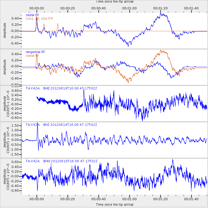
V42A Cord, AR, USA - Earthquake Result Viewer
*The percent match for this event was below the threshold and hence no stack was calculated.
| Earthquake location: |
Near Islands, Aleutian Islands |
| Earthquake latitude/longitude: |
53.4/171.6 |
| Earthquake time(UTC): |
2012/06/19 (171) 15:56:32 GMT |
| Earthquake Depth: |
14 km |
| Earthquake Magnitude: |
6.2 MB, 5.7 MS, 6.0 MW, 6.1 MW |
| Earthquake Catalog/Contributor: |
WHDF/NEIC |
|
| Network: |
TA USArray Transportable Network (new EarthScope stations) |
| Station: |
V42A Cord, AR, USA |
| Lat/Lon: |
35.81 N/91.39 W |
| Elevation: |
134 m |
|
| Distance: |
66.0 deg |
| Az: |
62.035 deg |
| Baz: |
319.353 deg |
| Ray Param: |
$rayparam |
*The percent match for this event was below the threshold and hence was not used in the summary stack. |
|
| Radial Match: |
58.45581 % |
| Radial Bump: |
400 |
| Transverse Match: |
51.95263 % |
| Transverse Bump: |
400 |
| SOD ConfigId: |
460165 |
| Insert Time: |
2013-02-11 22:17:40.812 +0000 |
| GWidth: |
2.5 |
| Max Bumps: |
400 |
| Tol: |
0.001 |
|
Signal To Noise
| Channel | StoN | STA | LTA |
| TA:V42A: :BHZ:20120619T16:06:47.17502Z | 9.084057 | 5.789416E-7 | 6.373161E-8 |
| TA:V42A: :BHN:20120619T16:06:47.17502Z | 2.2452714 | 2.1996047E-7 | 9.7966094E-8 |
| TA:V42A: :BHE:20120619T16:06:47.17502Z | 1.5759401 | 2.2694499E-7 | 1.440061E-7 |
| Arrivals |
| Ps | |
| PpPs | |
| PsPs/PpSs | |


