
P42A Winchester, IL, USA - Earthquake Result Viewer
| ||||||||||||||||||
| ||||||||||||||||||
| ||||||||||||||||||
|
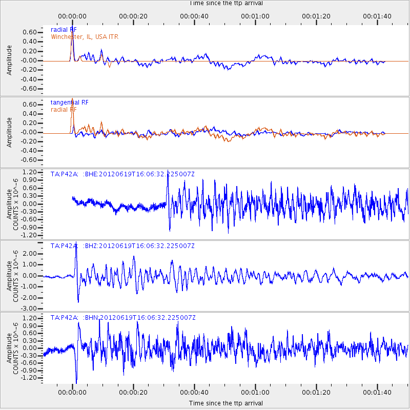
Signal To Noise
| Channel | StoN | STA | LTA |
| TA:P42A: :BHZ:20120619T16:06:32.225007Z | 17.438284 | 1.0518417E-6 | 6.031796E-8 |
| TA:P42A: :BHN:20120619T16:06:32.225007Z | 4.4572215 | 5.0161685E-7 | 1.12540256E-7 |
| TA:P42A: :BHE:20120619T16:06:32.225007Z | 3.2617579 | 4.2068655E-7 | 1.289754E-7 |
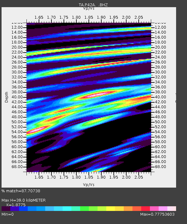
| Arrivals | |
| Ps | 5.5 SECOND |
| PpPs | 17 SECOND |
| PsPs/PpSs | 22 SECOND |

