U41A Viola, AR, USA - Earthquake Result Viewer
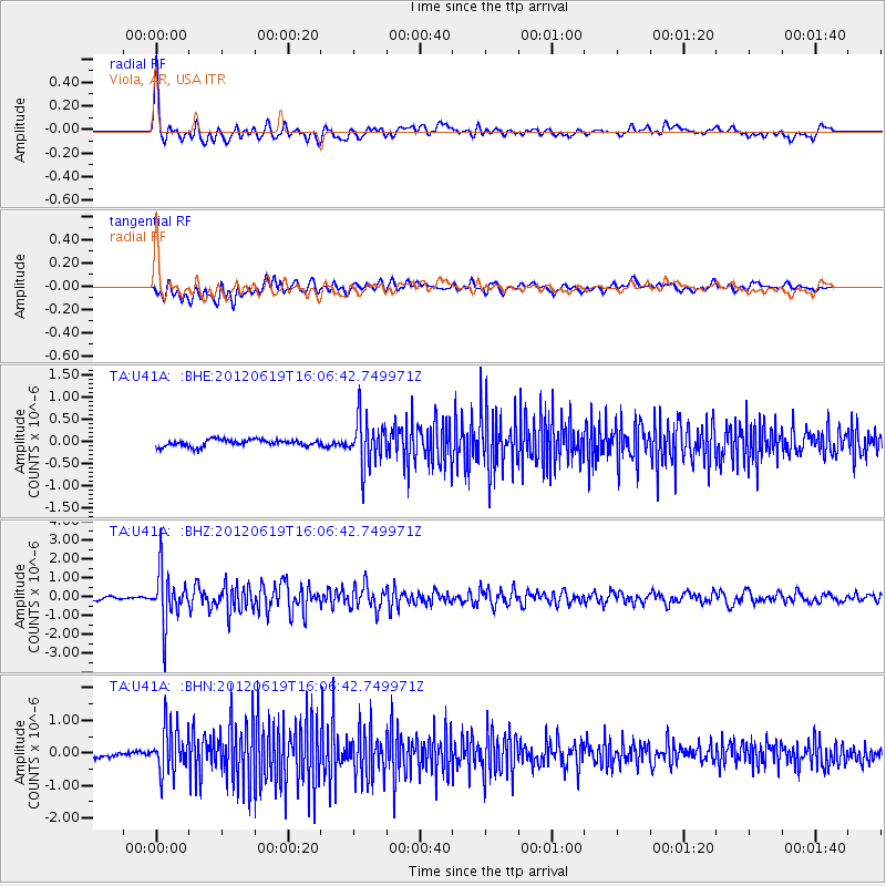
Earthquake location: Near Islands, Aleutian Islands
Earthquake latitude/longitude: 53.4/171.6
Earthquake time(UTC): 2012/06/19 (171) 15:56:32 GMT
Earthquake Depth: 14 km
Earthquake Magnitude: 6.2 MB, 5.7 MS, 6.0 MW, 6.1 MW
Earthquake Catalog/Contributor: WHDF/NEIC
Network: TA USArray Transportable Network (new EarthScope stations)
Station: U41A Viola, AR, USA
Lat/Lon: 36.34 N/91.92 W
Elevation: 300 m
Distance: 65.3 deg
Az: 62.007 deg
Baz: 319.031 deg
Ray Param: 0.0583513
Estimated Moho Depth: 38.25 km
Estimated Crust Vp/Vs: 2.01
Assumed Crust Vp: 6.53 km/s
Estimated Crust Vs: 3.253 km/s
Estimated Crust Poisson's Ratio: 0.33
Radial Match: 84.428444 %
Radial Bump: 400
Transverse Match: 75.860725 %
Transverse Bump: 400
SOD ConfigId: 460165
Insert Time: 2013-02-11 22:20:15.227 +0000
GWidth: 2.5
Max Bumps: 400
Tol: 0.001

Signal To Noise

ChannelStoNSTALTA
TA:U41A: :BHZ:20120619T16:06:42.749971Z19.2846411.3514577E-67.0079494E-8
TA:U41A: :BHN:20120619T16:06:42.749971Z12.3253427.1221365E-75.7784497E-8
TA:U41A: :BHE:20120619T16:06:42.749971Z6.97247745.320927E-77.631329E-8
Arrivals
Ps6.1 SECOND
PpPs17 SECOND
PsPs/PpSs23 SECOND