I39A Houston, MN, USA - Earthquake Result Viewer
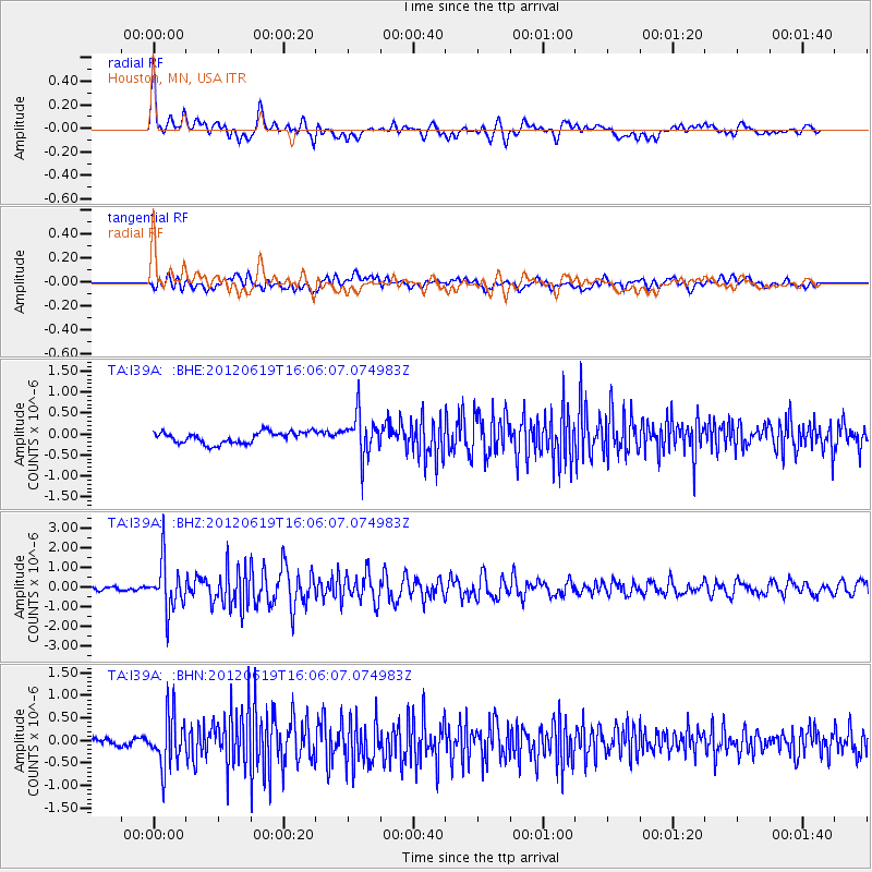
Earthquake location: Near Islands, Aleutian Islands
Earthquake latitude/longitude: 53.4/171.6
Earthquake time(UTC): 2012/06/19 (171) 15:56:32 GMT
Earthquake Depth: 14 km
Earthquake Magnitude: 6.2 MB, 5.7 MS, 6.0 MW, 6.1 MW
Earthquake Catalog/Contributor: WHDF/NEIC
Network: TA USArray Transportable Network (new EarthScope stations)
Station: I39A Houston, MN, USA
Lat/Lon: 43.85 N/91.52 W
Elevation: 393 m
Distance: 59.9 deg
Az: 56.079 deg
Baz: 316.556 deg
Ray Param: 0.06184568
Estimated Moho Depth: 58.25 km
Estimated Crust Vp/Vs: 1.73
Assumed Crust Vp: 6.53 km/s
Estimated Crust Vs: 3.78 km/s
Estimated Crust Poisson's Ratio: 0.25
Radial Match: 85.11656 %
Radial Bump: 400
Transverse Match: 63.19696 %
Transverse Bump: 400
SOD ConfigId: 460165
Insert Time: 2013-02-11 22:22:14.742 +0000
GWidth: 2.5
Max Bumps: 400
Tol: 0.001

Signal To Noise

ChannelStoNSTALTA
TA:I39A: :BHZ:20120619T16:06:07.074983Z16.6517751.2300476E-67.386886E-8
TA:I39A: :BHN:20120619T16:06:07.074983Z3.88070445.700131E-71.4688392E-7
TA:I39A: :BHE:20120619T16:06:07.074983Z3.60389884.8636787E-71.3495603E-7
Arrivals
Ps6.8 SECOND
PpPs23 SECOND
PsPs/PpSs30 SECOND