
H39A Augusta, WI, USA - Earthquake Result Viewer
| ||||||||||||||||||
| ||||||||||||||||||
| ||||||||||||||||||
|
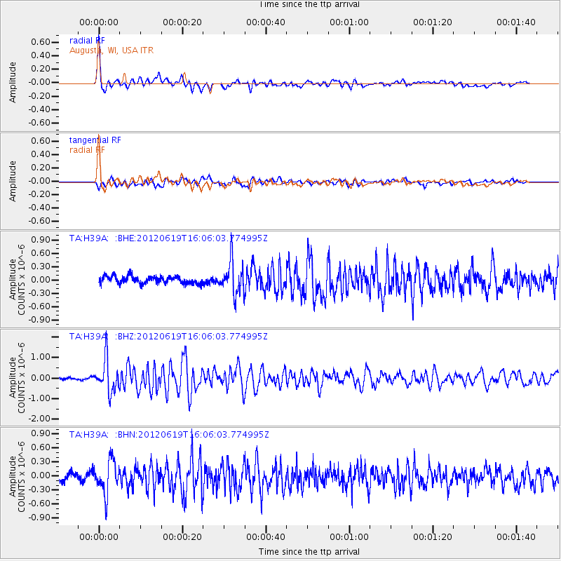
Signal To Noise
| Channel | StoN | STA | LTA |
| TA:H39A: :BHZ:20120619T16:06:03.774995Z | 10.082868 | 8.05808E-7 | 7.991853E-8 |
| TA:H39A: :BHN:20120619T16:06:03.774995Z | 4.1938214 | 3.6035533E-7 | 8.5925286E-8 |
| TA:H39A: :BHE:20120619T16:06:03.774995Z | 4.6333003 | 3.804658E-7 | 8.2115506E-8 |
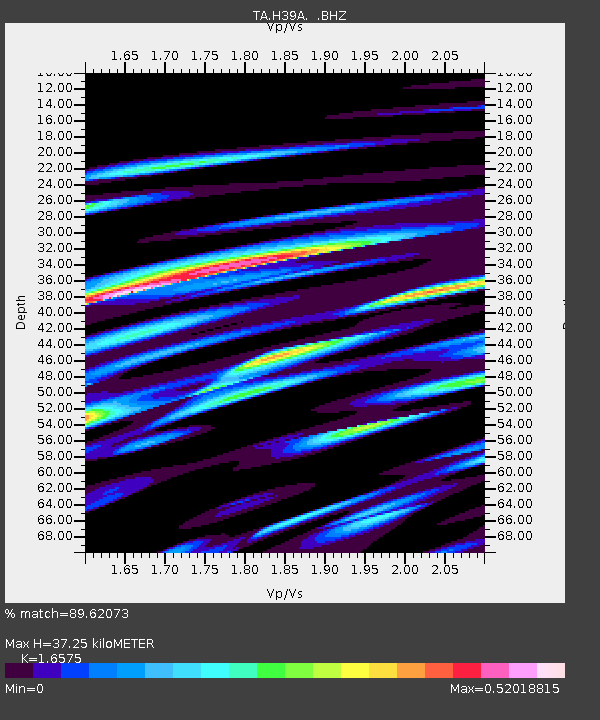
| Arrivals | |
| Ps | 3.9 SECOND |
| PpPs | 14 SECOND |
| PsPs/PpSs | 18 SECOND |

