H38A Maiden Rock, WI, USA - Earthquake Result Viewer
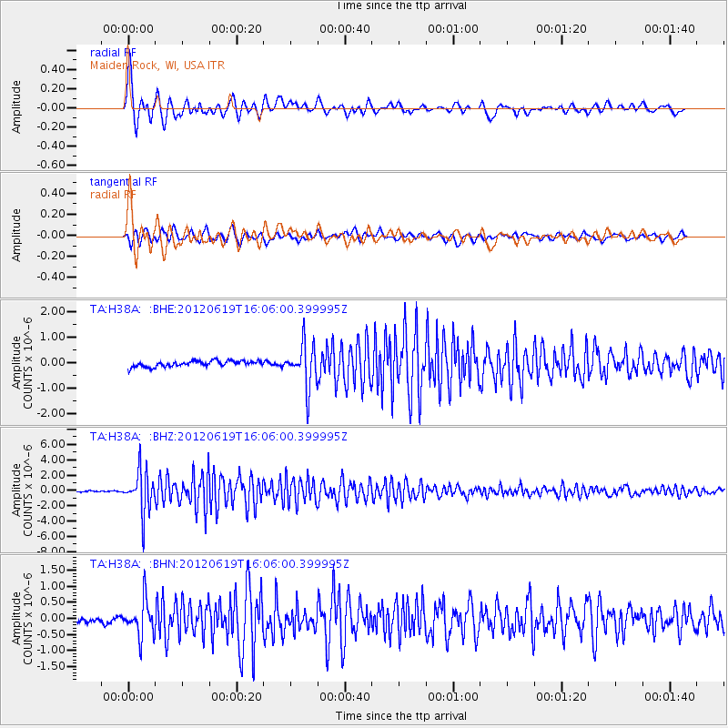
Earthquake location: Near Islands, Aleutian Islands
Earthquake latitude/longitude: 53.4/171.6
Earthquake time(UTC): 2012/06/19 (171) 15:56:32 GMT
Earthquake Depth: 14 km
Earthquake Magnitude: 6.2 MB, 5.7 MS, 6.0 MW, 6.1 MW
Earthquake Catalog/Contributor: WHDF/NEIC
Network: TA USArray Transportable Network (new EarthScope stations)
Station: H38A Maiden Rock, WI, USA
Lat/Lon: 44.68 N/92.28 W
Elevation: 333 m
Distance: 59.0 deg
Az: 55.877 deg
Baz: 315.925 deg
Ray Param: 0.06248387
Estimated Moho Depth: 35.5 km
Estimated Crust Vp/Vs: 1.94
Assumed Crust Vp: 6.571 km/s
Estimated Crust Vs: 3.383 km/s
Estimated Crust Poisson's Ratio: 0.32
Radial Match: 94.777954 %
Radial Bump: 400
Transverse Match: 88.50494 %
Transverse Bump: 400
SOD ConfigId: 460165
Insert Time: 2013-02-11 22:22:27.755 +0000
GWidth: 2.5
Max Bumps: 400
Tol: 0.001

Signal To Noise

ChannelStoNSTALTA
TA:H38A: :BHZ:20120619T16:06:00.399995Z36.6430742.68706E-67.333063E-8
TA:H38A: :BHN:20120619T16:06:00.399995Z5.2693095.627239E-71.06792726E-7
TA:H38A: :BHE:20120619T16:06:00.399995Z7.47512778.3678265E-71.1194226E-7
Arrivals
Ps5.3 SECOND
PpPs15 SECOND
PsPs/PpSs21 SECOND