G41A Antigo, WI, USA - Earthquake Result Viewer
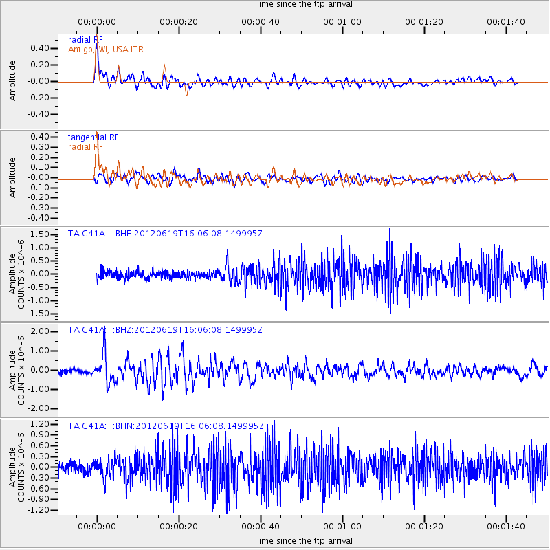
Earthquake location: Near Islands, Aleutian Islands
Earthquake latitude/longitude: 53.4/171.6
Earthquake time(UTC): 2012/06/19 (171) 15:56:32 GMT
Earthquake Depth: 14 km
Earthquake Magnitude: 6.2 MB, 5.7 MS, 6.0 MW, 6.1 MW
Earthquake Catalog/Contributor: WHDF/NEIC
Network: TA USArray Transportable Network (new EarthScope stations)
Station: G41A Antigo, WI, USA
Lat/Lon: 45.21 N/89.18 W
Elevation: 464 m
Distance: 60.1 deg
Az: 53.597 deg
Baz: 316.953 deg
Ray Param: 0.06174209
Estimated Moho Depth: 19.5 km
Estimated Crust Vp/Vs: 1.69
Assumed Crust Vp: 6.41 km/s
Estimated Crust Vs: 3.793 km/s
Estimated Crust Poisson's Ratio: 0.23
Radial Match: 85.085464 %
Radial Bump: 400
Transverse Match: 66.54751 %
Transverse Bump: 400
SOD ConfigId: 460165
Insert Time: 2013-02-11 22:23:15.345 +0000
GWidth: 2.5
Max Bumps: 400
Tol: 0.001

Signal To Noise

ChannelStoNSTALTA
TA:G41A: :BHZ:20120619T16:06:08.149995Z7.26518737.9004104E-71.08743386E-7
TA:G41A: :BHN:20120619T16:06:08.149995Z2.24950312.4694495E-71.0977755E-7
TA:G41A: :BHE:20120619T16:06:08.149995Z2.35742382.9267107E-71.2414868E-7
Arrivals
Ps2.2 SECOND
PpPs7.8 SECOND
PsPs/PpSs10.0 SECOND