
G42A Mountain, WI, USA - Earthquake Result Viewer
| ||||||||||||||||||
| ||||||||||||||||||
| ||||||||||||||||||
|
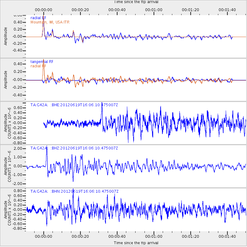
Signal To Noise
| Channel | StoN | STA | LTA |
| TA:G42A: :BHZ:20120619T16:06:10.475007Z | 9.8105955 | 7.445648E-7 | 7.5893944E-8 |
| TA:G42A: :BHN:20120619T16:06:10.475007Z | 2.9713614 | 2.3859462E-7 | 8.0298086E-8 |
| TA:G42A: :BHE:20120619T16:06:10.475007Z | 3.8556144 | 2.5520782E-7 | 6.619122E-8 |
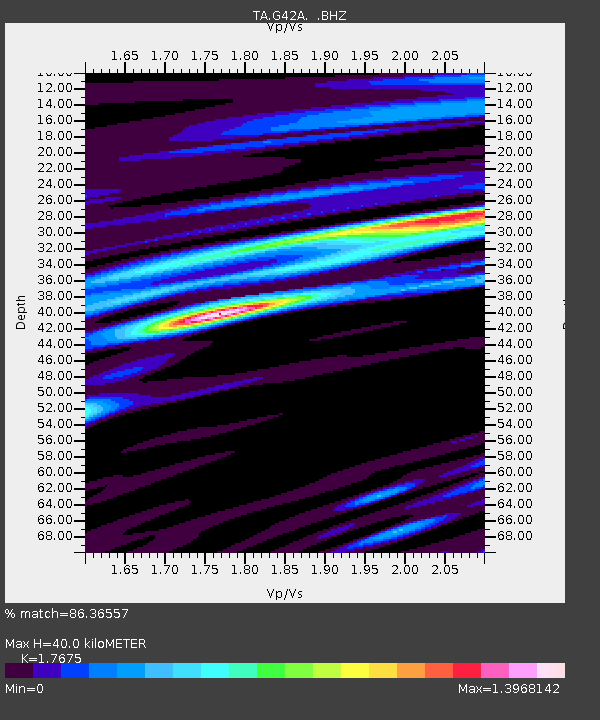
| Arrivals | |
| Ps | 5.0 SECOND |
| PpPs | 16 SECOND |
| PsPs/PpSs | 22 SECOND |

