J42A Columbus, WI, USA - Earthquake Result Viewer
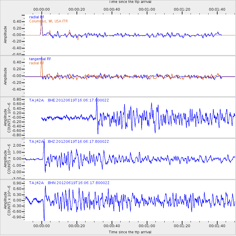
Earthquake location: Near Islands, Aleutian Islands
Earthquake latitude/longitude: 53.4/171.6
Earthquake time(UTC): 2012/06/19 (171) 15:56:32 GMT
Earthquake Depth: 14 km
Earthquake Magnitude: 6.2 MB, 5.7 MS, 6.0 MW, 6.1 MW
Earthquake Catalog/Contributor: WHDF/NEIC
Network: TA USArray Transportable Network (new EarthScope stations)
Station: J42A Columbus, WI, USA
Lat/Lon: 43.32 N/89.12 W
Elevation: 313 m
Distance: 61.5 deg
Az: 55.032 deg
Baz: 317.693 deg
Ray Param: 0.060808487
Estimated Moho Depth: 41.75 km
Estimated Crust Vp/Vs: 1.64
Assumed Crust Vp: 6.571 km/s
Estimated Crust Vs: 3.994 km/s
Estimated Crust Poisson's Ratio: 0.21
Radial Match: 83.76277 %
Radial Bump: 400
Transverse Match: 73.00638 %
Transverse Bump: 400
SOD ConfigId: 460165
Insert Time: 2013-02-11 22:26:40.082 +0000
GWidth: 2.5
Max Bumps: 400
Tol: 0.001

Signal To Noise

ChannelStoNSTALTA
TA:J42A: :BHZ:20120619T16:06:17.80002Z15.8107149.434353E-75.967063E-8
TA:J42A: :BHN:20120619T16:06:17.80002Z4.17156743.4231232E-78.205844E-8
TA:J42A: :BHE:20120619T16:06:17.80002Z6.2480873.0542282E-74.8882615E-8
Arrivals
Ps4.3 SECOND
PpPs16 SECOND
PsPs/PpSs20 SECOND