
T48A Bowling Green, KY, USA - Earthquake Result Viewer
| ||||||||||||||||||
| ||||||||||||||||||
| ||||||||||||||||||
|
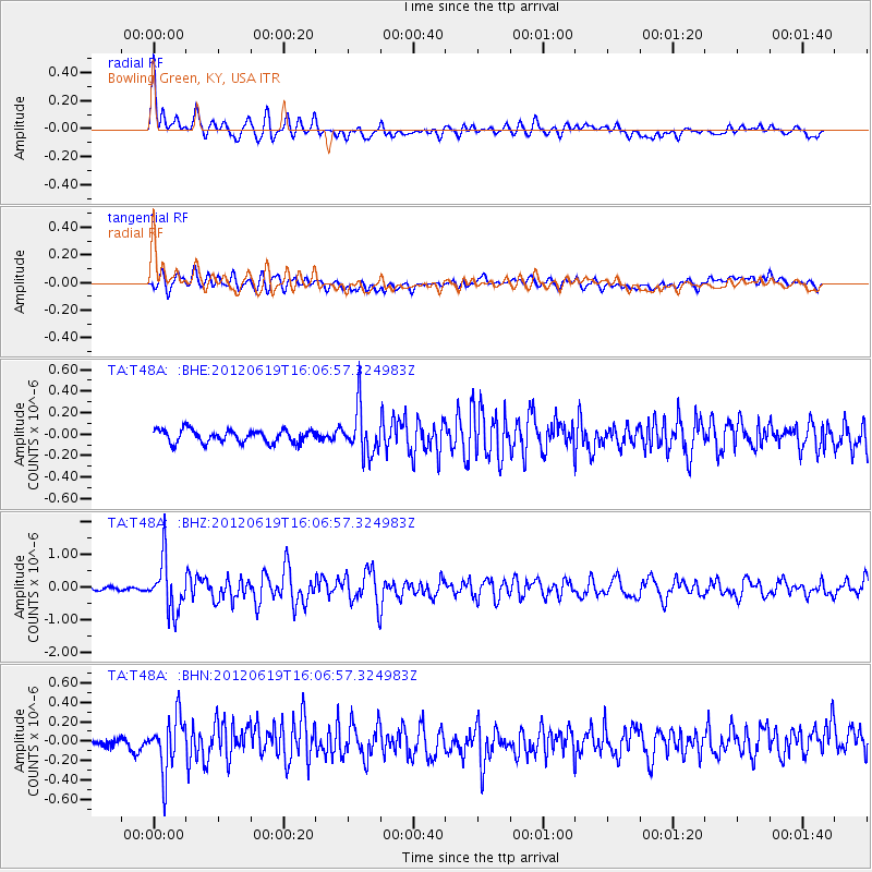
Signal To Noise
| Channel | StoN | STA | LTA |
| TA:T48A: :BHZ:20120619T16:06:57.324983Z | 17.168516 | 7.9460796E-7 | 4.6282853E-8 |
| TA:T48A: :BHN:20120619T16:06:57.324983Z | 6.168093 | 2.8259376E-7 | 4.5815415E-8 |
| TA:T48A: :BHE:20120619T16:06:57.324983Z | 3.6786003 | 2.1681774E-7 | 5.8940284E-8 |
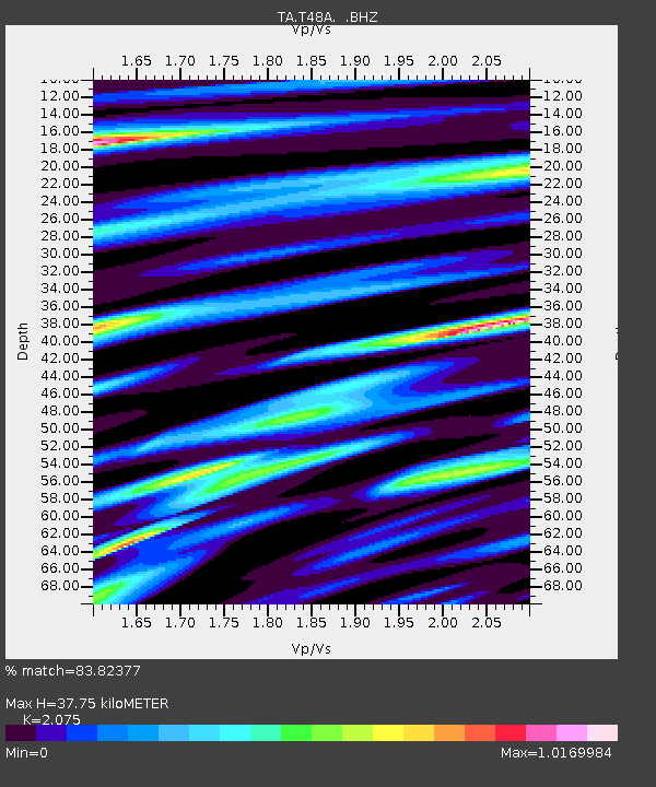
| Arrivals | |
| Ps | 6.5 SECOND |
| PpPs | 17 SECOND |
| PsPs/PpSs | 24 SECOND |

