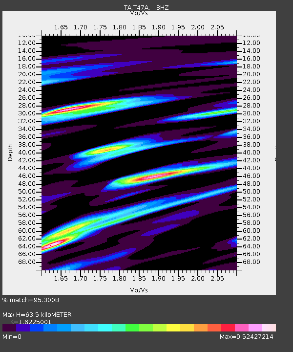
T47A Sharon Grove, KY, USA - Earthquake Result Viewer
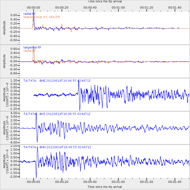
Earthquake location: Near Islands, Aleutian Islands
Earthquake latitude/longitude: 53.4/171.6
Earthquake time(UTC): 2012/06/19 (171) 15:56:32 GMT
Earthquake Depth: 14 km
Earthquake Magnitude: 6.2 MB, 5.7 MS, 6.0 MW, 6.1 MW
Earthquake Catalog/Contributor: WHDF/NEIC
Network: TA USArray Transportable Network (new EarthScope stations)
Station: T47A Sharon Grove, KY, USA
Lat/Lon: 36.99 N/87.11 W
Elevation: 217 m
Distance: 67.3 deg
Az: 58.328 deg
Baz: 320.416 deg
Ray Param: 0.057026934
Estimated Moho Depth: 63.5 km
Estimated Crust Vp/Vs: 1.62
Assumed Crust Vp: 6.444 km/s
Estimated Crust Vs: 3.972 km/s
Estimated Crust Poisson's Ratio: 0.19
Radial Match: 95.3008 %
Radial Bump: 324
Transverse Match: 76.21911 %
Transverse Bump: 400
SOD ConfigId: 460165
Insert Time: 2013-02-11 22:28:23.722 +0000
GWidth: 2.5
Max Bumps: 400
Tol: 0.001

Signal To Noise

ChannelStoNSTALTA
TA:T47A: :BHZ:20120619T16:06:55.624971Z30.9762651.5526482E-65.0123802E-8
TA:T47A: :BHN:20120619T16:06:55.624971Z9.2928217.968711E-78.575126E-8
TA:T47A: :BHE:20120619T16:06:55.624971Z9.5091845.1891516E-75.45699E-8
Arrivals
Ps6.4 SECOND
PpPs25 SECOND
PsPs/PpSs31 SECOND