You are here: Home > Network List > TA - USArray Transportable Network (new EarthScope stations) Stations List
> Station U46A Springville, TN, USA > Earthquake Result Viewer
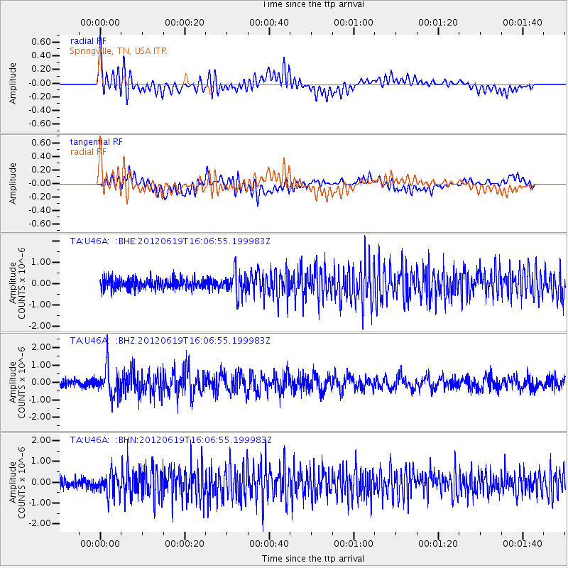
U46A Springville, TN, USA - Earthquake Result Viewer
*The percent match for this event was below the threshold and hence no stack was calculated.
| Earthquake location: |
Near Islands, Aleutian Islands |
| Earthquake latitude/longitude: |
53.4/171.6 |
| Earthquake time(UTC): |
2012/06/19 (171) 15:56:32 GMT |
| Earthquake Depth: |
14 km |
| Earthquake Magnitude: |
6.2 MB, 5.7 MS, 6.0 MW, 6.1 MW |
| Earthquake Catalog/Contributor: |
WHDF/NEIC |
|
| Network: |
TA USArray Transportable Network (new EarthScope stations) |
| Station: |
U46A Springville, TN, USA |
| Lat/Lon: |
36.36 N/88.18 W |
| Elevation: |
146 m |
|
| Distance: |
67.3 deg |
| Az: |
59.482 deg |
| Baz: |
320.224 deg |
| Ray Param: |
$rayparam |
*The percent match for this event was below the threshold and hence was not used in the summary stack. |
|
| Radial Match: |
72.50755 % |
| Radial Bump: |
400 |
| Transverse Match: |
57.75028 % |
| Transverse Bump: |
400 |
| SOD ConfigId: |
460165 |
| Insert Time: |
2013-02-11 22:28:31.151 +0000 |
| GWidth: |
2.5 |
| Max Bumps: |
400 |
| Tol: |
0.001 |
|
Signal To Noise
| Channel | StoN | STA | LTA |
| TA:U46A: :BHZ:20120619T16:06:55.199983Z | 3.2530637 | 8.320483E-7 | 2.5577376E-7 |
| TA:U46A: :BHN:20120619T16:06:55.199983Z | 2.0863068 | 5.182806E-7 | 2.4842015E-7 |
| TA:U46A: :BHE:20120619T16:06:55.199983Z | 2.268534 | 5.3136705E-7 | 2.342337E-7 |
| Arrivals |
| Ps | |
| PpPs | |
| PsPs/PpSs | |


