X46A Booneville, MS, USA - Earthquake Result Viewer
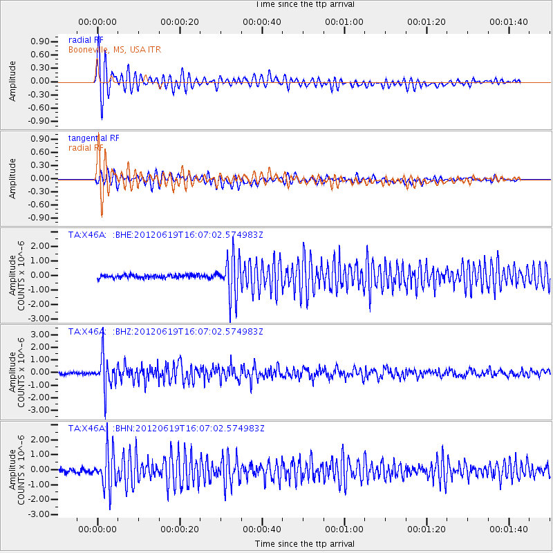
Earthquake location: Near Islands, Aleutian Islands
Earthquake latitude/longitude: 53.4/171.6
Earthquake time(UTC): 2012/06/19 (171) 15:56:32 GMT
Earthquake Depth: 14 km
Earthquake Magnitude: 6.2 MB, 5.7 MS, 6.0 MW, 6.1 MW
Earthquake Catalog/Contributor: WHDF/NEIC
Network: TA USArray Transportable Network (new EarthScope stations)
Station: X46A Booneville, MS, USA
Lat/Lon: 34.56 N/88.58 W
Elevation: 150 m
Distance: 68.4 deg
Az: 60.996 deg
Baz: 320.561 deg
Ray Param: 0.056304775
Estimated Moho Depth: 19.25 km
Estimated Crust Vp/Vs: 1.68
Assumed Crust Vp: 6.38 km/s
Estimated Crust Vs: 3.792 km/s
Estimated Crust Poisson's Ratio: 0.23
Radial Match: 94.79111 %
Radial Bump: 394
Transverse Match: 87.277115 %
Transverse Bump: 400
SOD ConfigId: 460165
Insert Time: 2013-02-11 22:28:55.311 +0000
GWidth: 2.5
Max Bumps: 400
Tol: 0.001

Signal To Noise

ChannelStoNSTALTA
TA:X46A: :BHZ:20120619T16:07:02.574983Z16.8019641.2586936E-67.491348E-8
TA:X46A: :BHN:20120619T16:07:02.574983Z10.1937481.2329369E-61.209503E-7
TA:X46A: :BHE:20120619T16:07:02.574983Z11.816431.3623114E-61.1528959E-7
Arrivals
Ps2.1 SECOND
PpPs7.8 SECOND
PsPs/PpSs9.9 SECOND