
X48A Hartselle, AL, USA - Earthquake Result Viewer
| ||||||||||||||||||
| ||||||||||||||||||
| ||||||||||||||||||
|
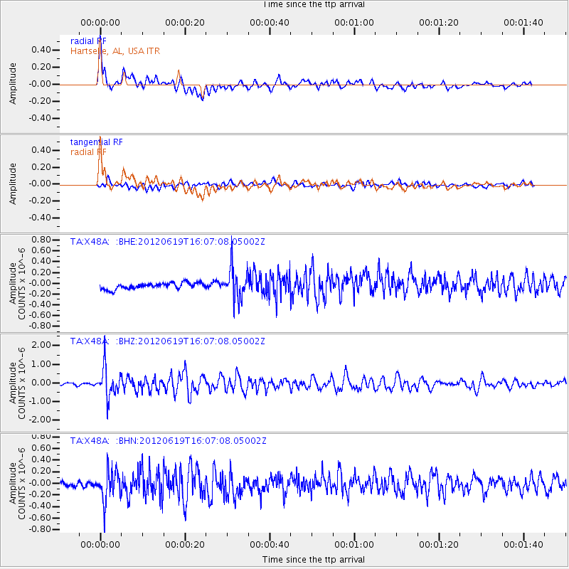
Signal To Noise
| Channel | StoN | STA | LTA |
| TA:X48A: :BHZ:20120619T16:07:08.05002Z | 12.945144 | 7.906796E-7 | 6.107924E-8 |
| TA:X48A: :BHN:20120619T16:07:08.05002Z | 4.322977 | 2.6971446E-7 | 6.23909E-8 |
| TA:X48A: :BHE:20120619T16:07:08.05002Z | 4.9204087 | 2.7879776E-7 | 5.6661506E-8 |
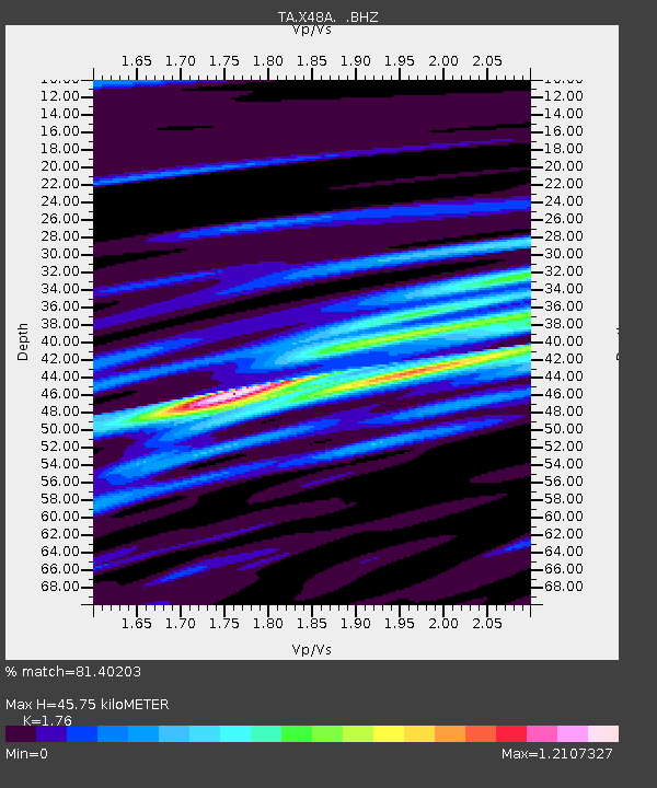
| Arrivals | |
| Ps | 5.6 SECOND |
| PpPs | 19 SECOND |
| PsPs/PpSs | 24 SECOND |

