
X50B Fort Payne, AL, USA - Earthquake Result Viewer
| ||||||||||||||||||
| ||||||||||||||||||
| ||||||||||||||||||
|
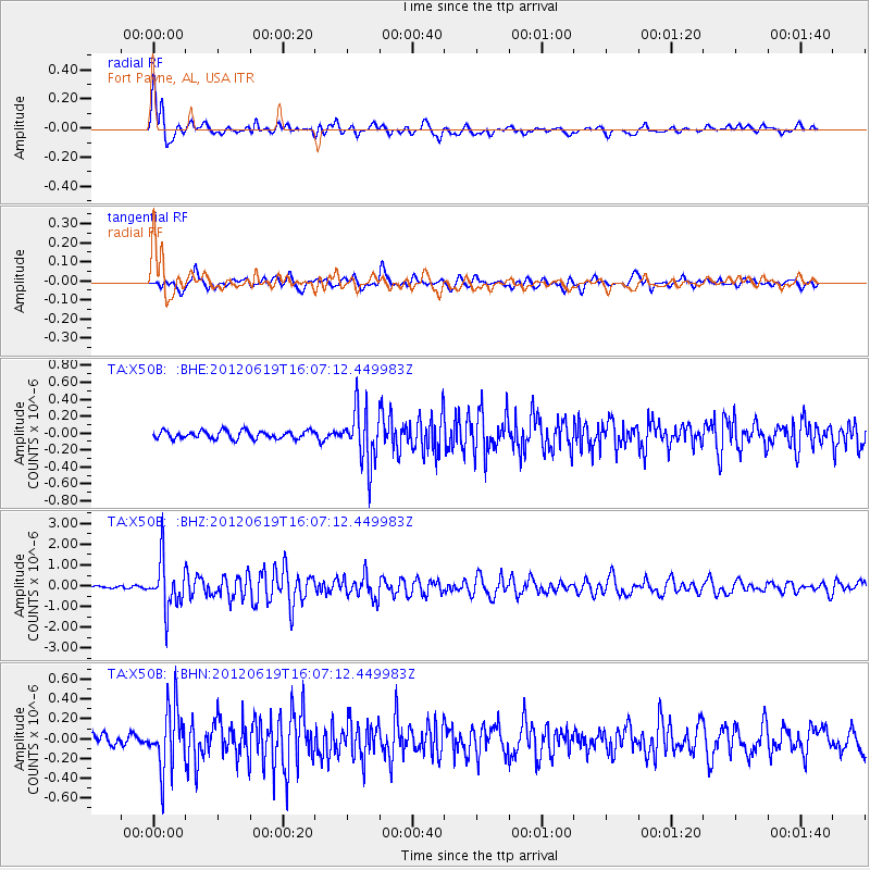
Signal To Noise
| Channel | StoN | STA | LTA |
| TA:X50B: :BHZ:20120619T16:07:12.449983Z | 16.540213 | 1.1646649E-6 | 7.0414146E-8 |
| TA:X50B: :BHN:20120619T16:07:12.449983Z | 6.377015 | 3.1423377E-7 | 4.9275997E-8 |
| TA:X50B: :BHE:20120619T16:07:12.449983Z | 6.8979216 | 3.2035223E-7 | 4.644185E-8 |
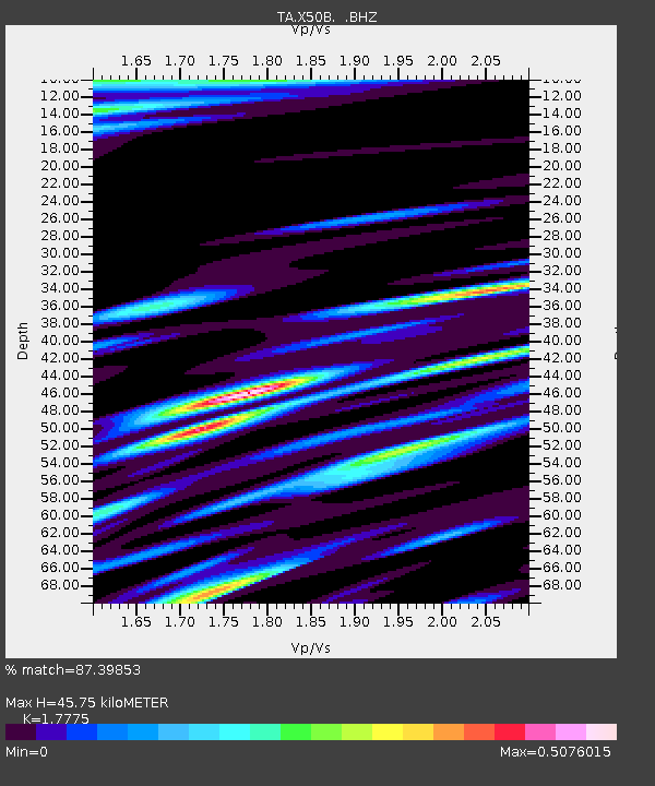
| Arrivals | |
| Ps | 5.8 SECOND |
| PpPs | 19 SECOND |
| PsPs/PpSs | 25 SECOND |

