
W48A Pulaski, TN, USA - Earthquake Result Viewer
| ||||||||||||||||||
| ||||||||||||||||||
| ||||||||||||||||||
|
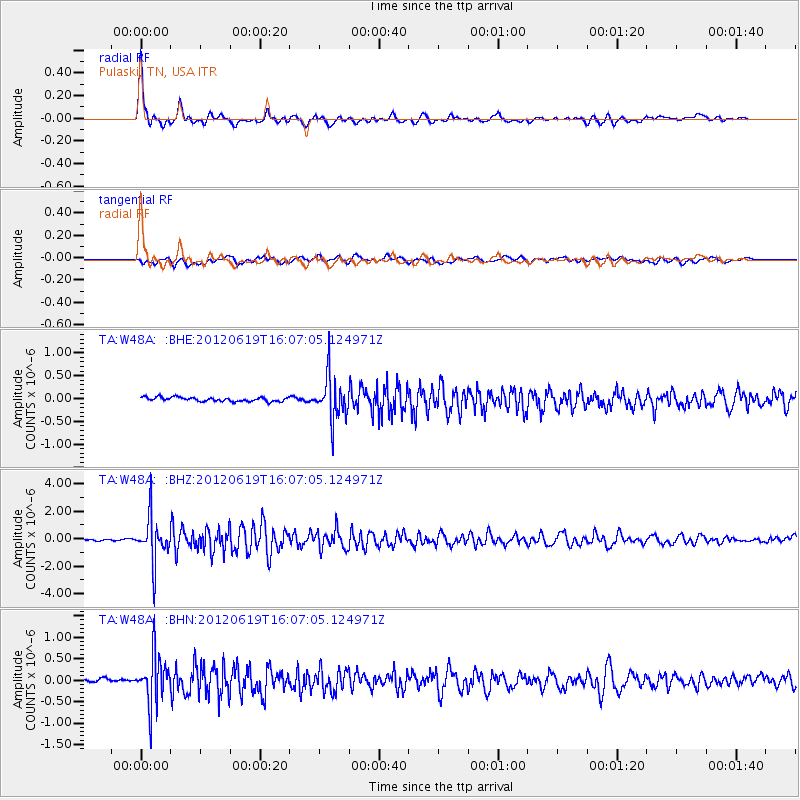
Signal To Noise
| Channel | StoN | STA | LTA |
| TA:W48A: :BHZ:20120619T16:07:05.124971Z | 30.314089 | 1.6440573E-6 | 5.42341E-8 |
| TA:W48A: :BHN:20120619T16:07:05.124971Z | 11.829469 | 5.843098E-7 | 4.9394426E-8 |
| TA:W48A: :BHE:20120619T16:07:05.124971Z | 10.695301 | 4.7630937E-7 | 4.453445E-8 |
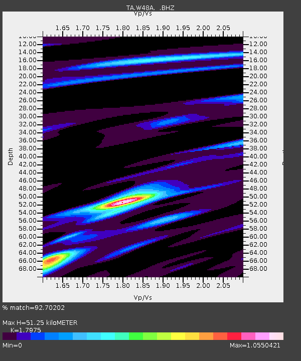
| Arrivals | |
| Ps | 6.6 SECOND |
| PpPs | 21 SECOND |
| PsPs/PpSs | 28 SECOND |

