You are here: Home > Network List > TA - USArray Transportable Network (new EarthScope stations) Stations List
> Station 352A Blakely, GA, USA > Earthquake Result Viewer
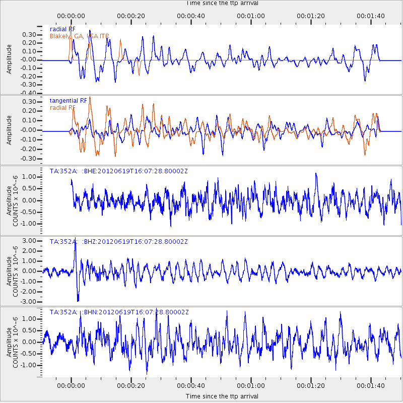
352A Blakely, GA, USA - Earthquake Result Viewer
*The percent match for this event was below the threshold and hence no stack was calculated.
| Earthquake location: |
Near Islands, Aleutian Islands |
| Earthquake latitude/longitude: |
53.4/171.6 |
| Earthquake time(UTC): |
2012/06/19 (171) 15:56:32 GMT |
| Earthquake Depth: |
14 km |
| Earthquake Magnitude: |
6.2 MB, 5.7 MS, 6.0 MW, 6.1 MW |
| Earthquake Catalog/Contributor: |
WHDF/NEIC |
|
| Network: |
TA USArray Transportable Network (new EarthScope stations) |
| Station: |
352A Blakely, GA, USA |
| Lat/Lon: |
31.48 N/84.93 W |
| Elevation: |
101 m |
|
| Distance: |
72.7 deg |
| Az: |
60.474 deg |
| Baz: |
322.371 deg |
| Ray Param: |
$rayparam |
*The percent match for this event was below the threshold and hence was not used in the summary stack. |
|
| Radial Match: |
65.60725 % |
| Radial Bump: |
400 |
| Transverse Match: |
60.46285 % |
| Transverse Bump: |
400 |
| SOD ConfigId: |
460165 |
| Insert Time: |
2013-02-11 22:32:50.492 +0000 |
| GWidth: |
2.5 |
| Max Bumps: |
400 |
| Tol: |
0.001 |
|
Signal To Noise
| Channel | StoN | STA | LTA |
| TA:352A: :BHZ:20120619T16:07:28.80002Z | 6.337582 | 1.2876583E-6 | 2.0317815E-7 |
| TA:352A: :BHN:20120619T16:07:28.80002Z | 1.1678903 | 4.1402726E-7 | 3.545087E-7 |
| TA:352A: :BHE:20120619T16:07:28.80002Z | 1.5159634 | 3.7608723E-7 | 2.4808463E-7 |
| Arrivals |
| Ps | |
| PpPs | |
| PsPs/PpSs | |


