153A Fort Valley, GA, USA - Earthquake Result Viewer
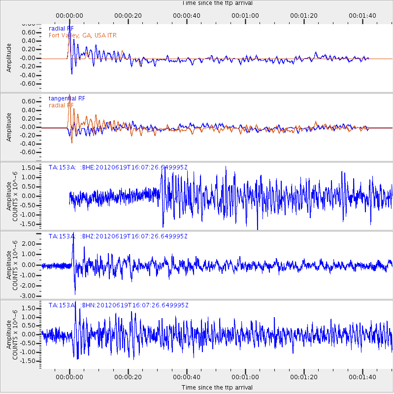
Earthquake location: Near Islands, Aleutian Islands
Earthquake latitude/longitude: 53.4/171.6
Earthquake time(UTC): 2012/06/19 (171) 15:56:32 GMT
Earthquake Depth: 14 km
Earthquake Magnitude: 6.2 MB, 5.7 MS, 6.0 MW, 6.1 MW
Earthquake Catalog/Contributor: WHDF/NEIC
Network: TA USArray Transportable Network (new EarthScope stations)
Station: 153A Fort Valley, GA, USA
Lat/Lon: 32.66 N/83.83 W
Elevation: 160 m
Distance: 72.4 deg
Az: 58.949 deg
Baz: 322.493 deg
Ray Param: 0.053696036
Estimated Moho Depth: 17.5 km
Estimated Crust Vp/Vs: 1.61
Assumed Crust Vp: 6.565 km/s
Estimated Crust Vs: 4.09 km/s
Estimated Crust Poisson's Ratio: 0.18
Radial Match: 86.65892 %
Radial Bump: 400
Transverse Match: 63.252323 %
Transverse Bump: 400
SOD ConfigId: 460165
Insert Time: 2013-02-11 22:33:52.800 +0000
GWidth: 2.5
Max Bumps: 400
Tol: 0.001

Signal To Noise

ChannelStoNSTALTA
TA:153A: :BHZ:20120619T16:07:26.649995Z6.3741239.376702E-71.4710575E-7
TA:153A: :BHN:20120619T16:07:26.649995Z3.3521216.9601873E-72.0763531E-7
TA:153A: :BHE:20120619T16:07:26.649995Z3.21766956.780815E-72.1073683E-7
Arrivals
Ps1.7 SECOND
PpPs6.7 SECOND
PsPs/PpSs8.3 SECOND