X51A Calhoun, GA, USA - Earthquake Result Viewer
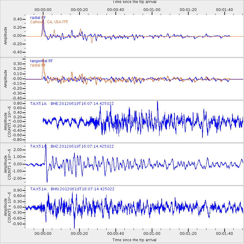
Earthquake location: Near Islands, Aleutian Islands
Earthquake latitude/longitude: 53.4/171.6
Earthquake time(UTC): 2012/06/19 (171) 15:56:32 GMT
Earthquake Depth: 14 km
Earthquake Magnitude: 6.2 MB, 5.7 MS, 6.0 MW, 6.1 MW
Earthquake Catalog/Contributor: WHDF/NEIC
Network: TA USArray Transportable Network (new EarthScope stations)
Station: X51A Calhoun, GA, USA
Lat/Lon: 34.57 N/84.86 W
Elevation: 214 m
Distance: 70.3 deg
Az: 58.43 deg
Baz: 321.762 deg
Ray Param: 0.055035945
Estimated Moho Depth: 46.25 km
Estimated Crust Vp/Vs: 2.06
Assumed Crust Vp: 6.35 km/s
Estimated Crust Vs: 3.09 km/s
Estimated Crust Poisson's Ratio: 0.34
Radial Match: 84.08333 %
Radial Bump: 400
Transverse Match: 68.106186 %
Transverse Bump: 400
SOD ConfigId: 460165
Insert Time: 2013-02-11 22:34:28.978 +0000
GWidth: 2.5
Max Bumps: 400
Tol: 0.001

Signal To Noise

ChannelStoNSTALTA
TA:X51A: :BHZ:20120619T16:07:14.42502Z8.8125851.0636484E-61.2069653E-7
TA:X51A: :BHN:20120619T16:07:14.42502Z4.77952962.8618805E-75.987788E-8
TA:X51A: :BHE:20120619T16:07:14.42502Z2.49057772.6487402E-71.0635043E-7
Arrivals
Ps7.9 SECOND
PpPs22 SECOND
PsPs/PpSs29 SECOND