
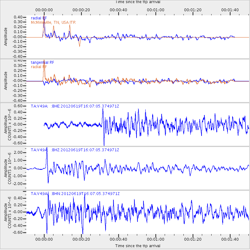
V49A McMinnville, TN, USA - Earthquake Result Viewer
| ||||||||||||||||||
| ||||||||||||||||||
| ||||||||||||||||||
|
Signal To Noise
| Channel | StoN | STA | LTA |
| TA:V49A: :BHZ:20120619T16:07:05.374971Z | 11.935891 | 8.931318E-7 | 7.482741E-8 |
| TA:V49A: :BHN:20120619T16:07:05.374971Z | 3.423939 | 2.2317785E-7 | 6.518161E-8 |
| TA:V49A: :BHE:20120619T16:07:05.374971Z | 4.717859 | 2.3195005E-7 | 4.9164267E-8 |
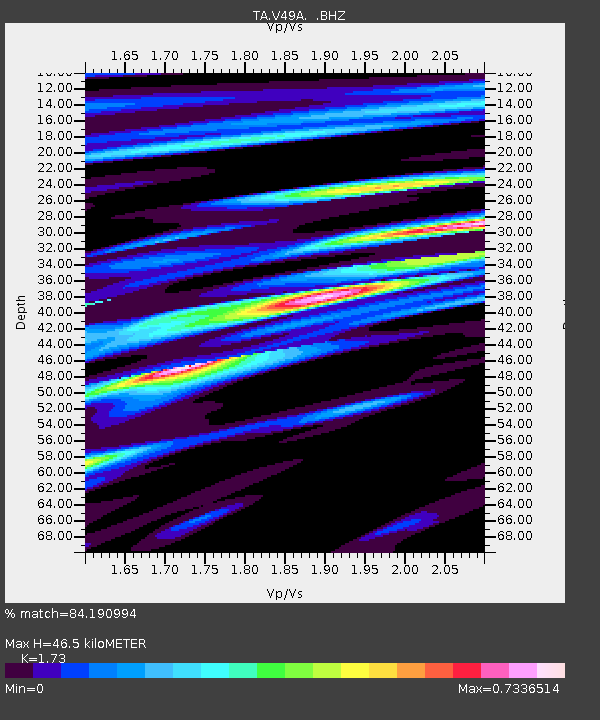
| Arrivals | |
| Ps | 5.6 SECOND |
| PpPs | 19 SECOND |
| PsPs/PpSs | 25 SECOND |

