V50A Pikevile, TN, USA - Earthquake Result Viewer
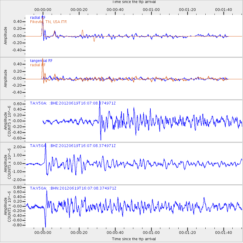
Earthquake location: Near Islands, Aleutian Islands
Earthquake latitude/longitude: 53.4/171.6
Earthquake time(UTC): 2012/06/19 (171) 15:56:32 GMT
Earthquake Depth: 14 km
Earthquake Magnitude: 6.2 MB, 5.7 MS, 6.0 MW, 6.1 MW
Earthquake Catalog/Contributor: WHDF/NEIC
Network: TA USArray Transportable Network (new EarthScope stations)
Station: V50A Pikevile, TN, USA
Lat/Lon: 35.67 N/85.10 W
Elevation: 287 m
Distance: 69.4 deg
Az: 57.867 deg
Baz: 321.429 deg
Ray Param: 0.05569231
Estimated Moho Depth: 66.0 km
Estimated Crust Vp/Vs: 1.88
Assumed Crust Vp: 6.35 km/s
Estimated Crust Vs: 3.387 km/s
Estimated Crust Poisson's Ratio: 0.30
Radial Match: 89.74544 %
Radial Bump: 400
Transverse Match: 66.04891 %
Transverse Bump: 400
SOD ConfigId: 460165
Insert Time: 2013-02-11 22:35:52.462 +0000
GWidth: 2.5
Max Bumps: 400
Tol: 0.001

Signal To Noise

ChannelStoNSTALTA
TA:V50A: :BHZ:20120619T16:07:08.374971Z18.3922238.630325E-74.692377E-8
TA:V50A: :BHN:20120619T16:07:08.374971Z7.4208932.9389787E-73.960411E-8
TA:V50A: :BHE:20120619T16:07:08.374971Z5.47724872.53088E-74.6207138E-8
Arrivals
Ps9.4 SECOND
PpPs29 SECOND
PsPs/PpSs38 SECOND