
S51A Beattyville, KY, USA - Earthquake Result Viewer
| ||||||||||||||||||
| ||||||||||||||||||
| ||||||||||||||||||
|
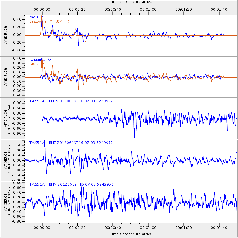
Signal To Noise
| Channel | StoN | STA | LTA |
| TA:S51A: :BHZ:20120619T16:07:03.524995Z | 7.92314 | 6.6230984E-7 | 8.359184E-8 |
| TA:S51A: :BHN:20120619T16:07:03.524995Z | 2.6791239 | 1.9224078E-7 | 7.175509E-8 |
| TA:S51A: :BHE:20120619T16:07:03.524995Z | 1.7081298 | 1.3018152E-7 | 7.62129E-8 |
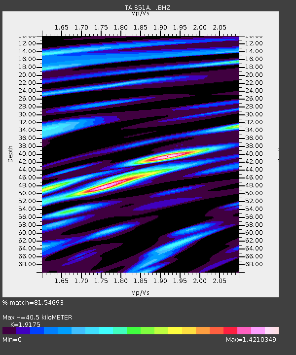
| Arrivals | |
| Ps | 5.9 SECOND |
| PpPs | 18 SECOND |
| PsPs/PpSs | 24 SECOND |

