T50A Nancy, KY, USA - Earthquake Result Viewer
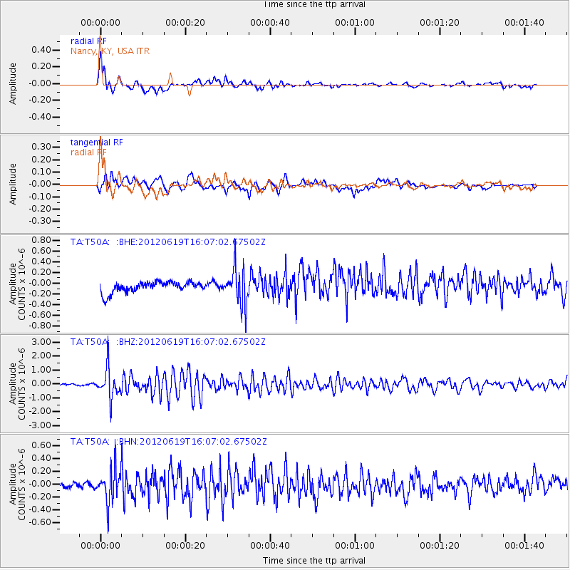
Earthquake location: Near Islands, Aleutian Islands
Earthquake latitude/longitude: 53.4/171.6
Earthquake time(UTC): 2012/06/19 (171) 15:56:32 GMT
Earthquake Depth: 14 km
Earthquake Magnitude: 6.2 MB, 5.7 MS, 6.0 MW, 6.1 MW
Earthquake Catalog/Contributor: WHDF/NEIC
Network: TA USArray Transportable Network (new EarthScope stations)
Station: T50A Nancy, KY, USA
Lat/Lon: 37.02 N/84.84 W
Elevation: 302 m
Distance: 68.4 deg
Az: 56.788 deg
Baz: 321.195 deg
Ray Param: 0.056294914
Estimated Moho Depth: 22.25 km
Estimated Crust Vp/Vs: 1.60
Assumed Crust Vp: 6.476 km/s
Estimated Crust Vs: 4.041 km/s
Estimated Crust Poisson's Ratio: 0.18
Radial Match: 89.0676 %
Radial Bump: 400
Transverse Match: 61.18397 %
Transverse Bump: 400
SOD ConfigId: 460165
Insert Time: 2013-02-11 22:37:04.590 +0000
GWidth: 2.5
Max Bumps: 400
Tol: 0.001

Signal To Noise

ChannelStoNSTALTA
TA:T50A: :BHZ:20120619T16:07:02.67502Z19.990011.0754776E-65.3800758E-8
TA:T50A: :BHN:20120619T16:07:02.67502Z4.12414262.6224575E-76.358795E-8
TA:T50A: :BHE:20120619T16:07:02.67502Z3.52859783.4692084E-79.831691E-8
Arrivals
Ps2.2 SECOND
PpPs8.6 SECOND
PsPs/PpSs11 SECOND