U51A La Follette, TN, USA - Earthquake Result Viewer
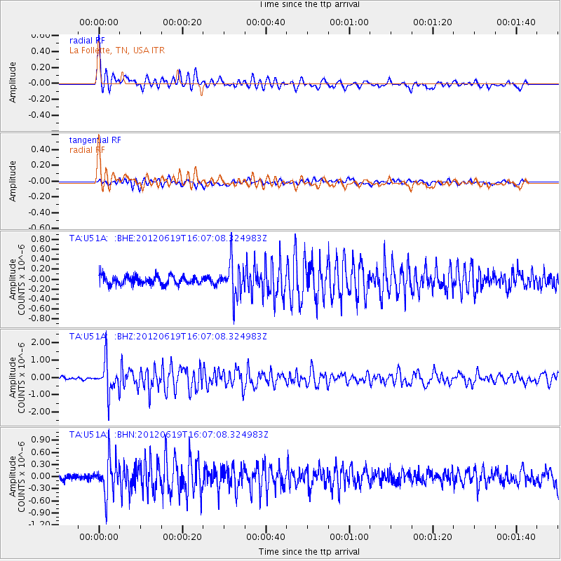
Earthquake location: Near Islands, Aleutian Islands
Earthquake latitude/longitude: 53.4/171.6
Earthquake time(UTC): 2012/06/19 (171) 15:56:32 GMT
Earthquake Depth: 14 km
Earthquake Magnitude: 6.2 MB, 5.7 MS, 6.0 MW, 6.1 MW
Earthquake Catalog/Contributor: WHDF/NEIC
Network: TA USArray Transportable Network (new EarthScope stations)
Station: U51A La Follette, TN, USA
Lat/Lon: 36.38 N/84.02 W
Elevation: 472 m
Distance: 69.4 deg
Az: 56.663 deg
Baz: 321.639 deg
Ray Param: 0.05569646
Estimated Moho Depth: 44.0 km
Estimated Crust Vp/Vs: 1.97
Assumed Crust Vp: 6.476 km/s
Estimated Crust Vs: 3.287 km/s
Estimated Crust Poisson's Ratio: 0.33
Radial Match: 87.978775 %
Radial Bump: 400
Transverse Match: 75.81888 %
Transverse Bump: 400
SOD ConfigId: 460165
Insert Time: 2013-02-11 22:37:21.979 +0000
GWidth: 2.5
Max Bumps: 400
Tol: 0.001

Signal To Noise

ChannelStoNSTALTA
TA:U51A: :BHZ:20120619T16:07:08.324983Z11.930819.422514E-77.897631E-8
TA:U51A: :BHN:20120619T16:07:08.324983Z4.7290524.50895E-79.534574E-8
TA:U51A: :BHE:20120619T16:07:08.324983Z3.9890323.5511437E-78.902269E-8
Arrivals
Ps6.8 SECOND
PpPs19 SECOND
PsPs/PpSs26 SECOND