T51A Gray, KY, USA - Earthquake Result Viewer
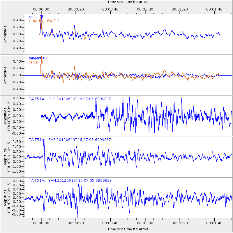
Earthquake location: Near Islands, Aleutian Islands
Earthquake latitude/longitude: 53.4/171.6
Earthquake time(UTC): 2012/06/19 (171) 15:56:32 GMT
Earthquake Depth: 14 km
Earthquake Magnitude: 6.2 MB, 5.7 MS, 6.0 MW, 6.1 MW
Earthquake Catalog/Contributor: WHDF/NEIC
Network: TA USArray Transportable Network (new EarthScope stations)
Station: T51A Gray, KY, USA
Lat/Lon: 36.97 N/83.95 W
Elevation: 329 m
Distance: 68.9 deg
Az: 56.225 deg
Baz: 321.525 deg
Ray Param: 0.055974875
Estimated Moho Depth: 47.5 km
Estimated Crust Vp/Vs: 1.74
Assumed Crust Vp: 6.476 km/s
Estimated Crust Vs: 3.716 km/s
Estimated Crust Poisson's Ratio: 0.25
Radial Match: 82.56642 %
Radial Bump: 400
Transverse Match: 68.863434 %
Transverse Bump: 400
SOD ConfigId: 460165
Insert Time: 2013-02-11 22:37:30.107 +0000
GWidth: 2.5
Max Bumps: 400
Tol: 0.001

Signal To Noise

ChannelStoNSTALTA
TA:T51A: :BHZ:20120619T16:07:05.699983Z7.06061556.9699956E-79.871654E-8
TA:T51A: :BHN:20120619T16:07:05.699983Z4.890922.477496E-75.0655007E-8
TA:T51A: :BHE:20120619T16:07:05.699983Z3.4933582.358149E-76.750379E-8
Arrivals
Ps5.7 SECOND
PpPs19 SECOND
PsPs/PpSs25 SECOND