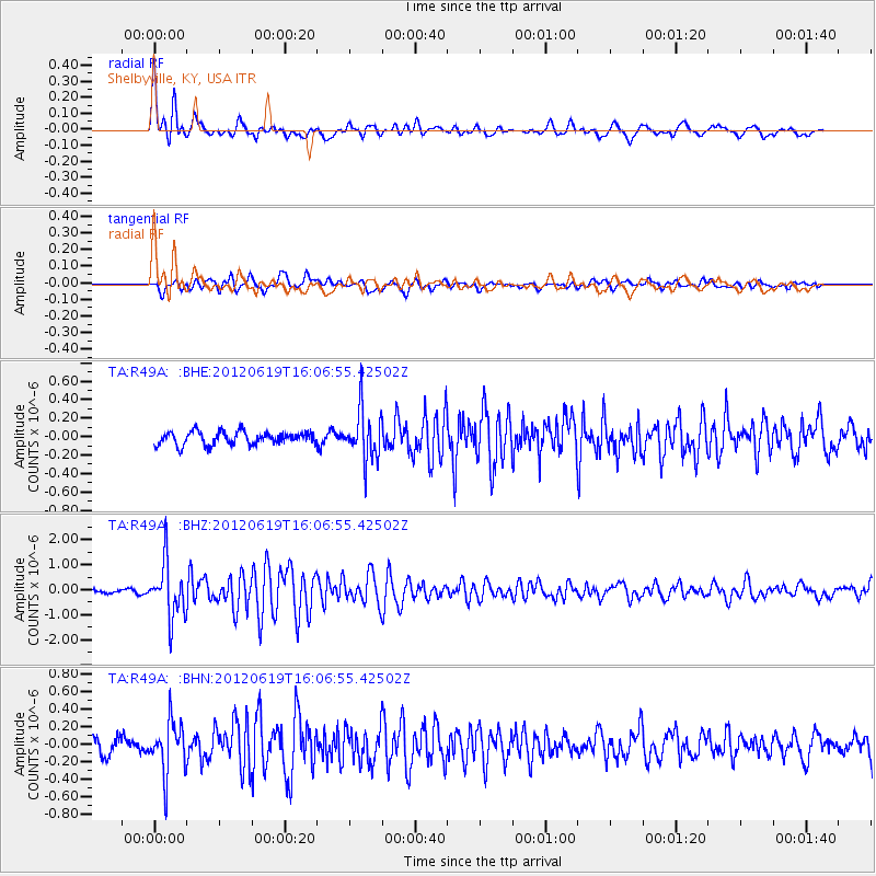
R49A Shelbyville, KY, USA - Earthquake Result Viewer
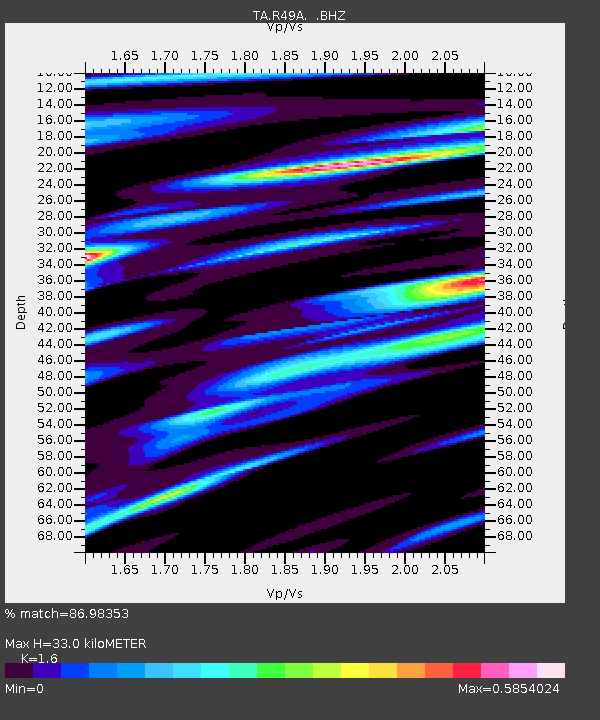
Earthquake location: Near Islands, Aleutian Islands
Earthquake latitude/longitude: 53.4/171.6
Earthquake time(UTC): 2012/06/19 (171) 15:56:32 GMT
Earthquake Depth: 14 km
Earthquake Magnitude: 6.2 MB, 5.7 MS, 6.0 MW, 6.1 MW
Earthquake Catalog/Contributor: WHDF/NEIC
Network: TA USArray Transportable Network (new EarthScope stations)
Station: R49A Shelbyville, KY, USA
Lat/Lon: 38.29 N/85.17 W
Elevation: 251 m
Distance: 67.3 deg
Az: 56.147 deg
Baz: 320.751 deg
Ray Param: 0.057046667
Estimated Moho Depth: 33.0 km
Estimated Crust Vp/Vs: 1.60
Assumed Crust Vp: 6.498 km/s
Estimated Crust Vs: 4.061 km/s
Estimated Crust Poisson's Ratio: 0.18
Radial Match: 86.98353 %
Radial Bump: 400
Transverse Match: 79.81731 %
Transverse Bump: 400
SOD ConfigId: 460165
Insert Time: 2013-02-11 22:37:43.549 +0000
GWidth: 2.5
Max Bumps: 400
Tol: 0.001

Signal To Noise

ChannelStoNSTALTA
TA:R49A: :BHZ:20120619T16:06:55.42502Z14.8176311.0915331E-67.366448E-8
TA:R49A: :BHN:20120619T16:06:55.42502Z3.28756332.9720022E-79.040137E-8
TA:R49A: :BHE:20120619T16:06:55.42502Z3.87531072.7065457E-76.9840745E-8
Arrivals
Ps3.2 SECOND
PpPs13 SECOND
PsPs/PpSs16 SECOND