
O50A Cable, OH, USA - Earthquake Result Viewer
| ||||||||||||||||||
| ||||||||||||||||||
| ||||||||||||||||||
|
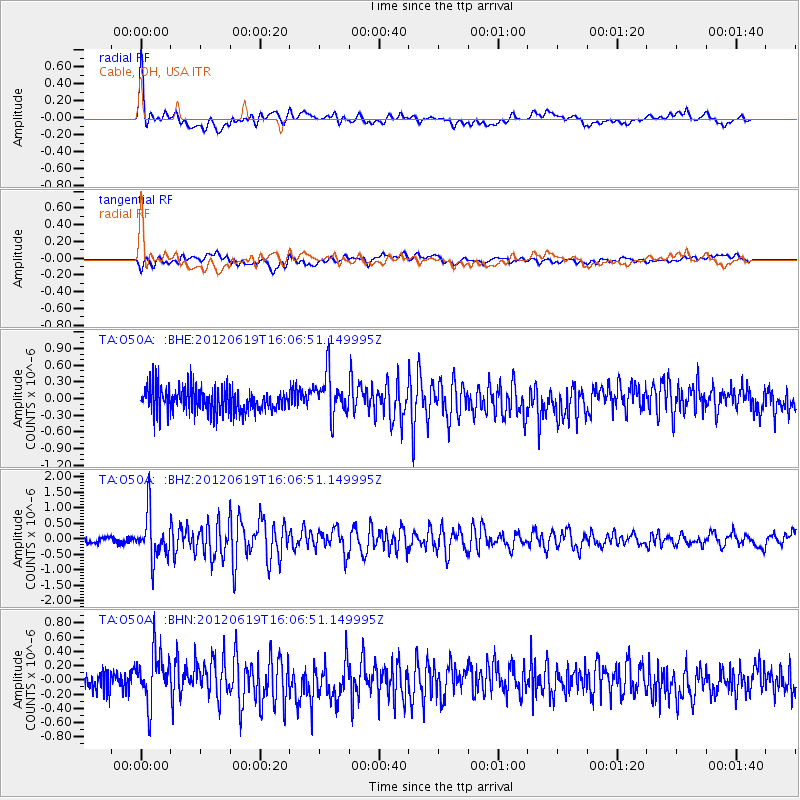
Signal To Noise
| Channel | StoN | STA | LTA |
| TA:O50A: :BHZ:20120619T16:06:51.149995Z | 6.440292 | 7.263715E-7 | 1.1278549E-7 |
| TA:O50A: :BHN:20120619T16:06:51.149995Z | 1.8647256 | 3.6854482E-7 | 1.9764025E-7 |
| TA:O50A: :BHE:20120619T16:06:51.149995Z | 1.7218643 | 3.7995653E-7 | 2.2066578E-7 |
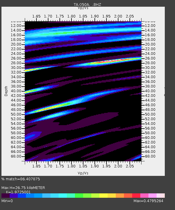
| Arrivals | |
| Ps | 4.2 SECOND |
| PpPs | 12 SECOND |
| PsPs/PpSs | 16 SECOND |

