You are here: Home > Network List > CI - Caltech Regional Seismic Network Stations List
> Station DAN Danby, California, USA > Earthquake Result Viewer
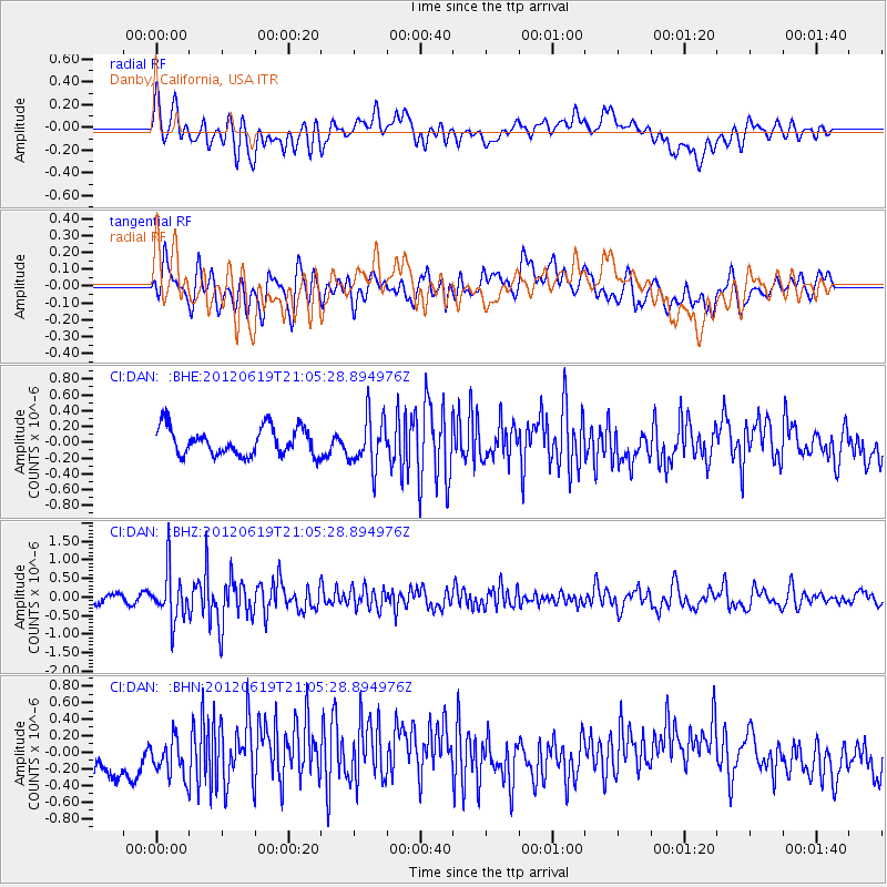
DAN Danby, California, USA - Earthquake Result Viewer
*The percent match for this event was below the threshold and hence no stack was calculated.
| Earthquake location: |
Near Islands, Aleutian Islands |
| Earthquake latitude/longitude: |
53.4/171.7 |
| Earthquake time(UTC): |
2012/06/19 (171) 20:56:41 GMT |
| Earthquake Depth: |
12 km |
| Earthquake Magnitude: |
5.9 MB, 5.2 MS, 5.6 MW, 5.7 MW |
| Earthquake Catalog/Contributor: |
WHDF/NEIC |
|
| Network: |
CI Caltech Regional Seismic Network |
| Station: |
DAN Danby, California, USA |
| Lat/Lon: |
34.64 N/115.38 W |
| Elevation: |
398 m |
|
| Distance: |
53.3 deg |
| Az: |
79.552 deg |
| Baz: |
314.357 deg |
| Ray Param: |
$rayparam |
*The percent match for this event was below the threshold and hence was not used in the summary stack. |
|
| Radial Match: |
56.151714 % |
| Radial Bump: |
400 |
| Transverse Match: |
59.38786 % |
| Transverse Bump: |
400 |
| SOD ConfigId: |
460165 |
| Insert Time: |
2013-02-11 22:47:32.473 +0000 |
| GWidth: |
2.5 |
| Max Bumps: |
400 |
| Tol: |
0.001 |
|
Signal To Noise
| Channel | StoN | STA | LTA |
| CI:DAN: :BHZ:20120619T21:05:28.894976Z | 7.2711716 | 6.625592E-7 | 9.1121386E-8 |
| CI:DAN: :BHN:20120619T21:05:28.894976Z | 1.1543181 | 2.596053E-7 | 2.2489927E-7 |
| CI:DAN: :BHE:20120619T21:05:28.894976Z | 1.8370476 | 3.2017718E-7 | 1.7428899E-7 |
| Arrivals |
| Ps | |
| PpPs | |
| PsPs/PpSs | |


