You are here: Home > Network List > CI - Caltech Regional Seismic Network Stations List
> Station SMM Simmler, CA, USA > Earthquake Result Viewer
SMM Simmler, CA, USA - Earthquake Result Viewer
*The percent match for this event was below the threshold and hence no stack was calculated.
| Earthquake location: |
Near Islands, Aleutian Islands |
| Earthquake latitude/longitude: |
53.4/171.7 |
| Earthquake time(UTC): |
2012/06/19 (171) 20:56:41 GMT |
| Earthquake Depth: |
12 km |
| Earthquake Magnitude: |
5.9 MB, 5.2 MS, 5.6 MW, 5.7 MW |
| Earthquake Catalog/Contributor: |
WHDF/NEIC |
|
| Network: |
CI Caltech Regional Seismic Network |
| Station: |
SMM Simmler, CA, USA |
| Lat/Lon: |
35.31 N/120.00 W |
| Elevation: |
599 m |
|
| Distance: |
50.1 deg |
| Az: |
82.281 deg |
| Baz: |
313.415 deg |
| Ray Param: |
$rayparam |
*The percent match for this event was below the threshold and hence was not used in the summary stack. |
|
| Radial Match: |
64.70684 % |
| Radial Bump: |
400 |
| Transverse Match: |
50.64103 % |
| Transverse Bump: |
400 |
| SOD ConfigId: |
460165 |
| Insert Time: |
2013-02-11 22:48:19.636 +0000 |
| GWidth: |
2.5 |
| Max Bumps: |
400 |
| Tol: |
0.001 |
|
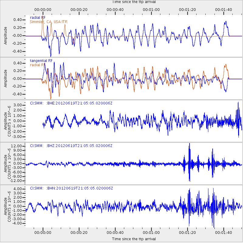
Signal To Noise
| Channel | StoN | STA | LTA |
| CI:SMM: :BHZ:20120619T21:05:05.020006Z | 2.1526337 | 9.0943655E-7 | 4.2247626E-7 |
| CI:SMM: :BHN:20120619T21:05:05.020006Z | 1.094813 | 5.858444E-7 | 5.351091E-7 |
| CI:SMM: :BHE:20120619T21:05:05.020006Z | 0.72347933 | 4.4943846E-7 | 6.212181E-7 |
| Arrivals |
| Ps | |
| PpPs | |
| PsPs/PpSs | |


