You are here: Home > Network List > CI - Caltech Regional Seismic Network Stations List
> Station MPP McPhearson Peak > Earthquake Result Viewer
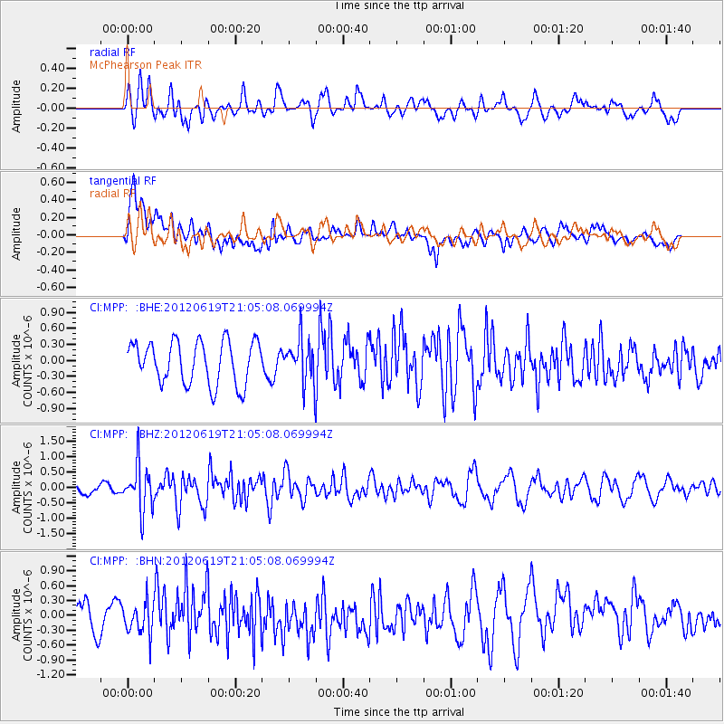
MPP McPhearson Peak - Earthquake Result Viewer
*The percent match for this event was below the threshold and hence no stack was calculated.
| Earthquake location: |
Near Islands, Aleutian Islands |
| Earthquake latitude/longitude: |
53.4/171.7 |
| Earthquake time(UTC): |
2012/06/19 (171) 20:56:41 GMT |
| Earthquake Depth: |
12 km |
| Earthquake Magnitude: |
5.9 MB, 5.2 MS, 5.6 MW, 5.7 MW |
| Earthquake Catalog/Contributor: |
WHDF/NEIC |
|
| Network: |
CI Caltech Regional Seismic Network |
| Station: |
MPP McPhearson Peak |
| Lat/Lon: |
34.89 N/119.81 W |
| Elevation: |
1739 m |
|
| Distance: |
50.5 deg |
| Az: |
82.547 deg |
| Baz: |
313.69 deg |
| Ray Param: |
$rayparam |
*The percent match for this event was below the threshold and hence was not used in the summary stack. |
|
| Radial Match: |
67.01061 % |
| Radial Bump: |
400 |
| Transverse Match: |
61.999397 % |
| Transverse Bump: |
400 |
| SOD ConfigId: |
460165 |
| Insert Time: |
2013-02-11 22:48:40.719 +0000 |
| GWidth: |
2.5 |
| Max Bumps: |
400 |
| Tol: |
0.001 |
|
Signal To Noise
| Channel | StoN | STA | LTA |
| CI:MPP: :BHZ:20120619T21:05:08.069994Z | 2.2678676 | 7.4622295E-7 | 3.2904168E-7 |
| CI:MPP: :BHN:20120619T21:05:08.069994Z | 0.6940986 | 3.2563926E-7 | 4.6915417E-7 |
| CI:MPP: :BHE:20120619T21:05:08.069994Z | 1.040709 | 4.14681E-7 | 3.984601E-7 |
| Arrivals |
| Ps | |
| PpPs | |
| PsPs/PpSs | |


