You are here: Home > Network List > IW - Intermountain West Stations List
> Station MOOW Moose Ponds, Wyoming, USA > Earthquake Result Viewer
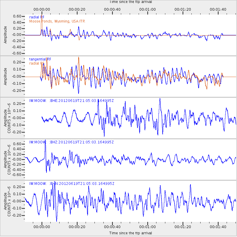
MOOW Moose Ponds, Wyoming, USA - Earthquake Result Viewer
*The percent match for this event was below the threshold and hence no stack was calculated.
| Earthquake location: |
Near Islands, Aleutian Islands |
| Earthquake latitude/longitude: |
53.4/171.7 |
| Earthquake time(UTC): |
2012/06/19 (171) 20:56:41 GMT |
| Earthquake Depth: |
12 km |
| Earthquake Magnitude: |
5.9 MB, 5.2 MS, 5.6 MW, 5.7 MW |
| Earthquake Catalog/Contributor: |
WHDF/NEIC |
|
| Network: |
IW Intermountain West |
| Station: |
MOOW Moose Ponds, Wyoming, USA |
| Lat/Lon: |
43.75 N/110.74 W |
| Elevation: |
2128 m |
|
| Distance: |
49.8 deg |
| Az: |
67.849 deg |
| Baz: |
309.988 deg |
| Ray Param: |
$rayparam |
*The percent match for this event was below the threshold and hence was not used in the summary stack. |
|
| Radial Match: |
52.13311 % |
| Radial Bump: |
400 |
| Transverse Match: |
56.8463 % |
| Transverse Bump: |
400 |
| SOD ConfigId: |
460165 |
| Insert Time: |
2013-02-11 22:52:49.226 +0000 |
| GWidth: |
2.5 |
| Max Bumps: |
400 |
| Tol: |
0.001 |
|
Signal To Noise
| Channel | StoN | STA | LTA |
| IW:MOOW: :BHZ:20120619T21:05:03.164995Z | 3.936881 | 2.6074093E-7 | 6.623033E-8 |
| IW:MOOW: :BHN:20120619T21:05:03.164995Z | 2.229562 | 1.0024511E-7 | 4.496179E-8 |
| IW:MOOW: :BHE:20120619T21:05:03.164995Z | 1.9518889 | 9.664766E-8 | 4.951494E-8 |
| Arrivals |
| Ps | |
| PpPs | |
| PsPs/PpSs | |


