
E31A Nome, ND, USA - Earthquake Result Viewer
| ||||||||||||||||||
| ||||||||||||||||||
| ||||||||||||||||||
|
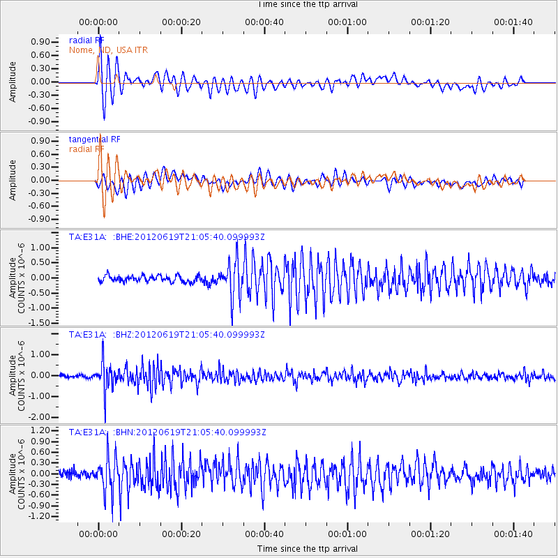
Signal To Noise
| Channel | StoN | STA | LTA |
| TA:E31A: :BHZ:20120619T21:05:40.099993Z | 15.822732 | 6.778515E-7 | 4.284036E-8 |
| TA:E31A: :BHN:20120619T21:05:40.099993Z | 4.441599 | 4.8802127E-7 | 1.09875145E-7 |
| TA:E31A: :BHE:20120619T21:05:40.099993Z | 6.1075406 | 6.067215E-7 | 9.933975E-8 |
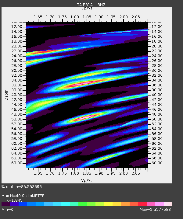
| Arrivals | |
| Ps | 6.7 SECOND |
| PpPs | 20 SECOND |
| PsPs/PpSs | 27 SECOND |

