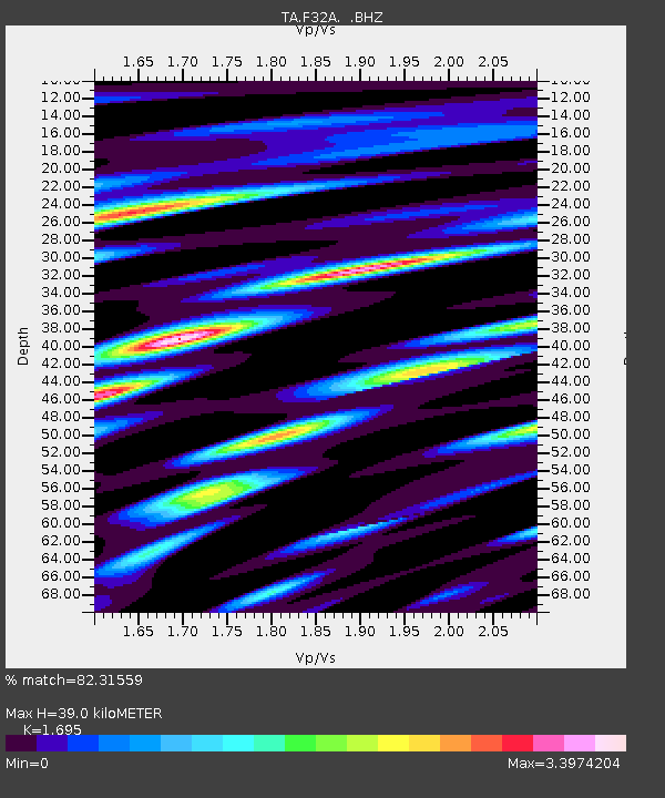
F32A Veblen, SD, USA - Earthquake Result Viewer
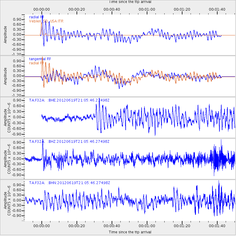
Earthquake location: Near Islands, Aleutian Islands
Earthquake latitude/longitude: 53.4/171.7
Earthquake time(UTC): 2012/06/19 (171) 20:56:41 GMT
Earthquake Depth: 12 km
Earthquake Magnitude: 5.9 MB, 5.2 MS, 5.6 MW, 5.7 MW
Earthquake Catalog/Contributor: WHDF/NEIC
Network: TA USArray Transportable Network (new EarthScope stations)
Station: F32A Veblen, SD, USA
Lat/Lon: 45.87 N/97.13 W
Elevation: 371 m
Distance: 55.7 deg
Az: 57.774 deg
Baz: 313.461 deg
Ray Param: 0.064641386
Estimated Moho Depth: 39.0 km
Estimated Crust Vp/Vs: 1.70
Assumed Crust Vp: 6.552 km/s
Estimated Crust Vs: 3.866 km/s
Estimated Crust Poisson's Ratio: 0.23
Radial Match: 82.31559 %
Radial Bump: 400
Transverse Match: 70.139366 %
Transverse Bump: 400
SOD ConfigId: 460165
Insert Time: 2013-02-11 23:06:09.150 +0000
GWidth: 2.5
Max Bumps: 400
Tol: 0.001

Signal To Noise

ChannelStoNSTALTA
TA:F32A: :BHZ:20120619T21:05:46.27498Z4.15188743.3645344E-78.103627E-8
TA:F32A: :BHN:20120619T21:05:46.27498Z2.65380263.0687704E-71.1563673E-7
TA:F32A: :BHE:20120619T21:05:46.27498Z5.83566334.866472E-78.3391924E-8
Arrivals
Ps4.4 SECOND
PpPs15 SECOND
PsPs/PpSs20 SECOND