
T47A Sharon Grove, KY, USA - Earthquake Result Viewer
| ||||||||||||||||||
| ||||||||||||||||||
| ||||||||||||||||||
|
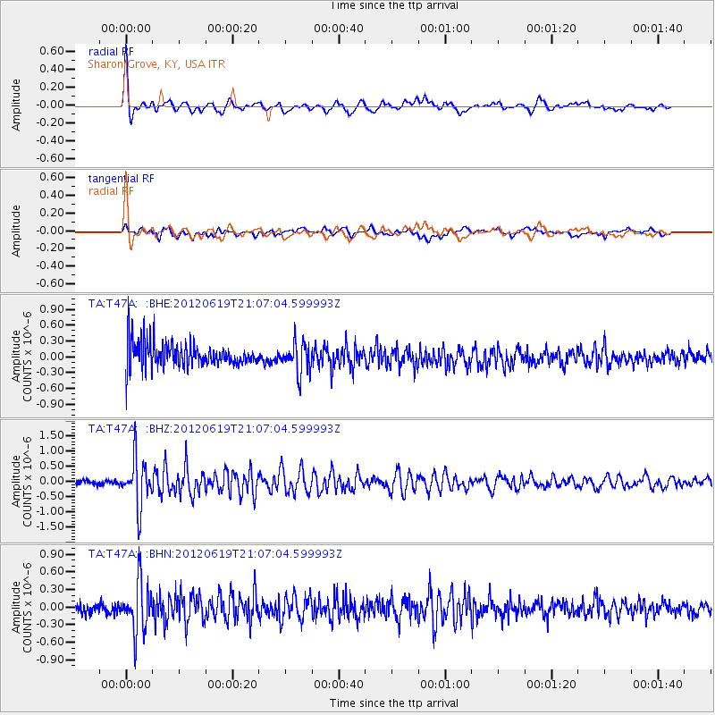
Signal To Noise
| Channel | StoN | STA | LTA |
| TA:T47A: :BHZ:20120619T21:07:04.599993Z | 5.488214 | 8.056177E-7 | 1.467905E-7 |
| TA:T47A: :BHN:20120619T21:07:04.599993Z | 2.3394494 | 4.306728E-7 | 1.8409152E-7 |
| TA:T47A: :BHE:20120619T21:07:04.599993Z | 1.268628 | 2.9719382E-7 | 2.3426396E-7 |
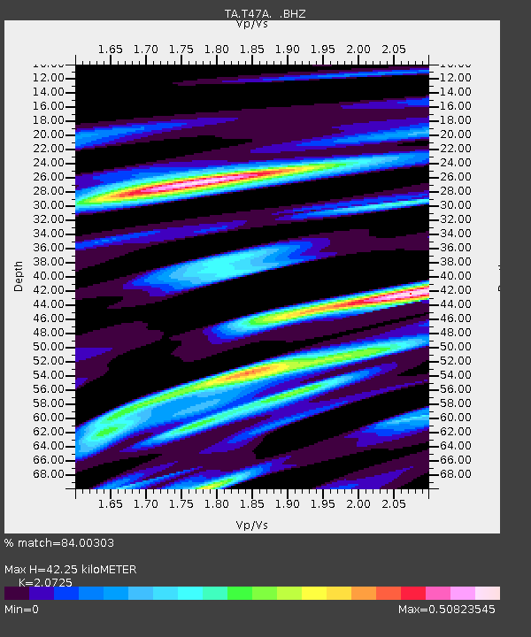
| Arrivals | |
| Ps | 7.3 SECOND |
| PpPs | 19 SECOND |
| PsPs/PpSs | 27 SECOND |

