
Z55A Blythe, GA, USA - Earthquake Result Viewer
| ||||||||||||||||||
| ||||||||||||||||||
| ||||||||||||||||||
|
Signal To Noise
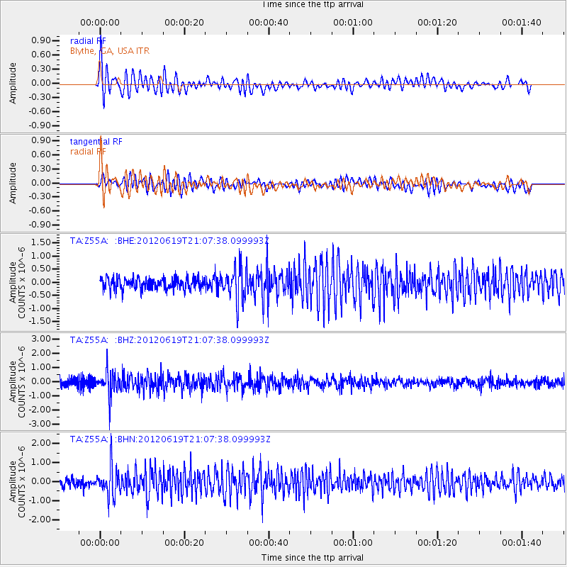
| Channel | StoN | STA | LTA |
| TA:Z55A: :BHZ:20120619T21:07:38.099993Z | 2.9604042 | 8.3607006E-7 | 2.8241755E-7 |
| TA:Z55A: :BHN:20120619T21:07:38.099993Z | 3.8023696 | 7.714235E-7 | 2.0287968E-7 |
| TA:Z55A: :BHE:20120619T21:07:38.099993Z | 3.1491833 | 6.6841744E-7 | 2.1225105E-7 |
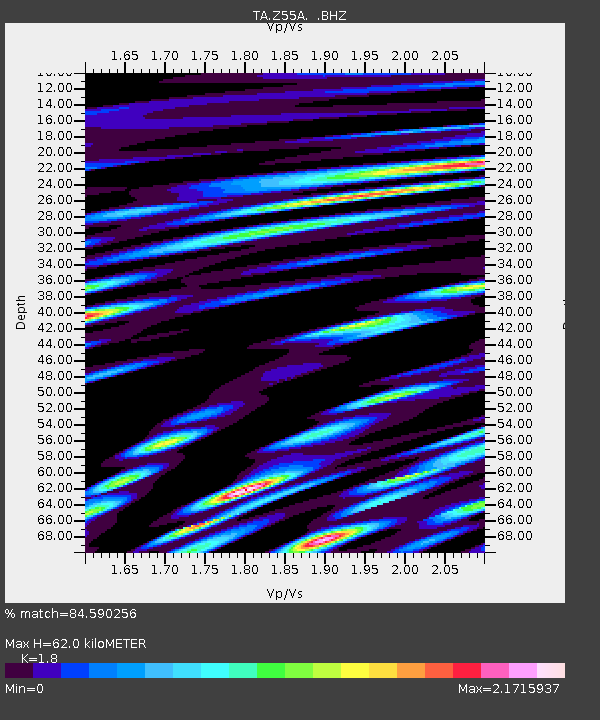
| Arrivals | |
| Ps | 7.8 SECOND |
| PpPs | 26 SECOND |
| PsPs/PpSs | 33 SECOND |

