You are here: Home > Network List > AZ - ANZA Regional Network Stations List
> Station SMER AZ.SMER > Earthquake Result Viewer
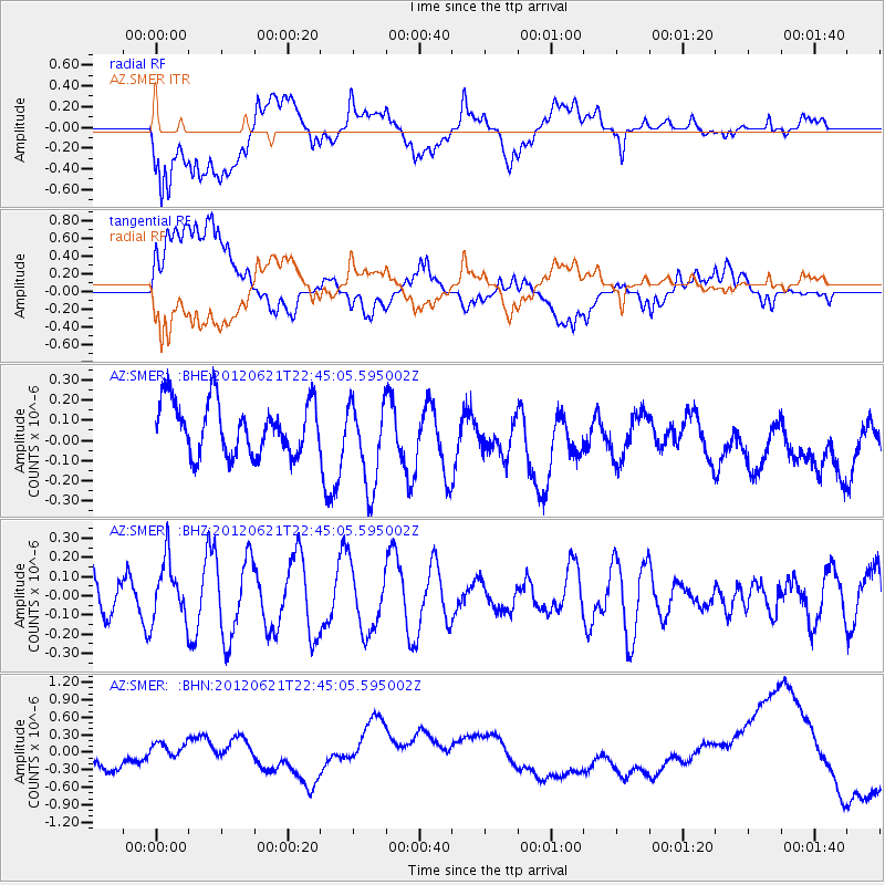
SMER AZ.SMER - Earthquake Result Viewer
*The percent match for this event was below the threshold and hence no stack was calculated.
| Earthquake location: |
Fiji Islands Region |
| Earthquake latitude/longitude: |
-18.0/-178.2 |
| Earthquake time(UTC): |
2012/06/21 (173) 22:34:37 GMT |
| Earthquake Depth: |
543 km |
| Earthquake Magnitude: |
5.5 MW, 5.2 MB, 5.5 MW |
| Earthquake Catalog/Contributor: |
WHDF/NEIC |
|
| Network: |
AZ ANZA Regional Network |
| Station: |
SMER AZ.SMER |
| Lat/Lon: |
33.46 N/117.17 W |
| Elevation: |
355 m |
|
| Distance: |
77.4 deg |
| Az: |
48.521 deg |
| Baz: |
238.544 deg |
| Ray Param: |
$rayparam |
*The percent match for this event was below the threshold and hence was not used in the summary stack. |
|
| Radial Match: |
18.581348 % |
| Radial Bump: |
400 |
| Transverse Match: |
20.482069 % |
| Transverse Bump: |
400 |
| SOD ConfigId: |
460165 |
| Insert Time: |
2013-02-11 23:58:19.063 +0000 |
| GWidth: |
2.5 |
| Max Bumps: |
400 |
| Tol: |
0.001 |
|
Signal To Noise
| Channel | StoN | STA | LTA |
| AZ:SMER: :BHZ:20120621T22:45:05.595002Z | 1.4083453 | 1.5880168E-7 | 1.1275763E-7 |
| AZ:SMER: :BHN:20120621T22:45:05.595002Z | 1.1136128 | 2.1777142E-7 | 1.9555397E-7 |
| AZ:SMER: :BHE:20120621T22:45:05.595002Z | 1.6602273 | 2.1585869E-7 | 1.3001755E-7 |
| Arrivals |
| Ps | |
| PpPs | |
| PsPs/PpSs | |


